San Casciano in Val di Pesa night lights from space
Night Light of San Casciano in Val di Pesa (Tuscany) from space (Italy) Src. Average luminocity for 10x10km area is 12.0167% and for 50x50km: 23.481%.
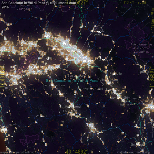
Analysis of San Casciano in Val di Pesa night lights 2016
Square area 10x10 km:
 0%
0%90-99
0.61%80-89
1.21%70-79
0.61%60-69
2.12%50-59
1.82%40-49
2.42%30-39
2.58%20-29
3.03%10-19
14.39%0-9
71.21%Square area 50x50 km:
4.84%90-99
4.98%80-89
1.71%70-79
1.84%60-69
2.62%50-59
3.35%40-49
3.11%30-39
2.69%20-29
6.9%10-19
14.01%0-9
53.97%Clear (daylight) street map image can be seen on geolist.org.
Map coordinates:
44° 9' 58.6" North, 10° 28' 54.6" East
43° 39' 35.1" North, 11° 11' 5.8" East
43° 8' 56.1" North, 11° 53' 17.1" East
Some cities around San Casciano in Val di Pesa sort by population:
• Florence
14.2 km =8.8 mi,  20°
20°
• Scandicci
10.5 km =6.5 mi,  1°
1°
• Lastra a Signa
13.6 km =8.5 mi,  334°
334°
• Montelupo Fiorentino
16.1 km =10 mi,  298°
298°
• Grassina Ponte a Ema
12.3 km =7.6 mi,  48°
48°
• Tavarnelle Val di Pesa
10.9 km =6.8 mi,  185°
185°
• San Donnino
15.4 km =9.6 mi,  348°
348°
• Bagno a Ripoli
15 km =9.3 mi, 47°
3168498 (p: 6,216)
Sources (retrieved 2019-11-25):
» Earth at Night: Flat Maps 2012, 2016