Lastra a Signa night lights from space
Night Light of Lastra a Signa (Tuscany) from space (Italy) Src. Average luminocity for 10x10km area is 55.3485% and for 50x50km: 28.6981%.
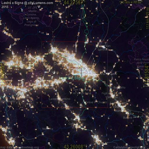
Analysis of Lastra a Signa night lights 2016
Square area 10x10 km:
 13.94%
90-99
14.24%80-89
1.52%70-79
7.73%60-69
6.52%50-59
7.58%40-49
6.52%30-39
5.45%20-29
21.06%10-19
15.3%0-9
0.15%Square area 50x50 km:
5.88%90-99
5.79%80-89
2.08%70-79
2.44%60-69
3.31%50-59
4.12%40-49
4.19%30-39
3.86%20-29
9.91%10-19
15.41%0-9
43.01%Clear (daylight) street map image can be seen on geolist.org.
Map coordinates:
44° 16' 32.1" North, 10° 24' 34.5" East
43° 46' 11.9" North, 11° 6' 45.8" East
43° 15' 36.3" North, 11° 48' 57" East
Some cities around Lastra a Signa sort by population:
• Sesto Fiorentino
9.8 km =6.1 mi,  45°
45°
• Scandicci
6.3 km =3.9 mi,  106°
106°
• Campi Bisenzio
6.2 km =3.9 mi,  13°
13°
• Signa
2.8 km =1.7 mi,  344°
344°
• Montelupo Fiorentino
9.4 km =5.8 mi,  241°
241°
• Poggio A Caiano
6.9 km =4.3 mi,  314°
314°
• Seano
9.9 km =6.2 mi, 312°
• San Donnino
3.9 km =2.4 mi,  43°
43°
3175074 (p: 11,504)
Sources (retrieved 2019-11-25):
» Earth at Night: Flat Maps 2012, 2016