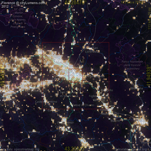
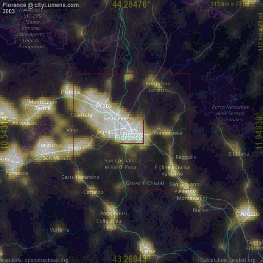
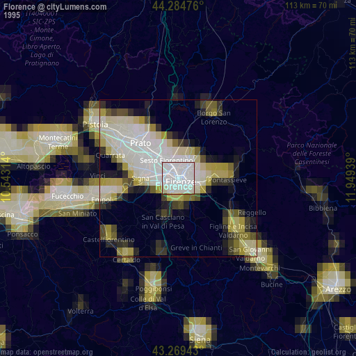
Florence night lights from space
Night Light of Florence (Tuscany) from space (Italy) Src. Average luminocity for 10x10km area is 84.0318% and for 50x50km: 25.2057%.
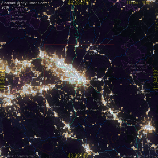
Analysis of Florence night lights 2016
Square area 10x10 km:
 33.33%
90-99
28.33%80-89
6.97%70-79
4.7%60-69
7.27%50-59
8.94%40-49
5.15%30-39
4.24%20-29
1.06%10-19
0%0-9
0%Square area 50x50 km:
5.4%90-99
5.23%80-89
1.8%70-79
1.98%60-69
2.87%50-59
3.81%40-49
3.49%30-39
3.2%20-29
6.72%10-19
13.46%0-9
52.05%Clear (daylight) street map image can be seen on geolist.org.
Map coordinates:
44° 17' 5.1" North, 10° 32' 35.3" East
43° 46' 45.3" North, 11° 14' 46.5" East
43° 16' 9.9" North, 11° 56' 57.8" East
Some cities around Florence sort by population:
• Sesto Fiorentino
7 km =4.3 mi,  327°
327°
• Scandicci
5.4 km =3.4 mi,  239°
239°
• Campi Bisenzio
10.6 km =6.6 mi,  298°
298°
• Calenzano
10.6 km =6.6 mi,  322°
322°
• Lastra a Signa
10.8 km =6.7 mi,  264°
264°
• Grassina Ponte a Ema
6.7 km =4.2 mi,  139°
139°
• San Donnino
8.2 km =5.1 mi,  282°
282°
• Bagno a Ripoli
6.9 km =4.3 mi,  117°
117°
3176959 (p: 349,296)
Sources (retrieved 2019-11-25):
» NASA, Earths city lights 1995
» NASA city lights 2003
» Earth at Night: Flat Maps 2012, 2016