Modena night lights from space
Night Light of Modena (Emilia-Romagna) from space (Italy) Src. Average luminocity for 10x10km area is 78.7015% and for 50x50km: 36.9264%.
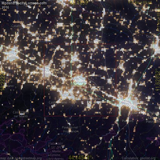
Analysis of Modena night lights 2016
Square area 10x10 km:
 26.82%
90-99
22.73%80-89
6.52%70-79
7.58%60-69
9.24%50-59
12.12%40-49
9.09%30-39
4.09%20-29
1.82%10-19
0%0-9
0%Square area 50x50 km:
6.09%90-99
7.51%80-89
3.31%70-79
2.85%60-69
3.73%50-59
4.84%40-49
6.54%30-39
7.54%20-29
15.26%10-19
25.99%0-9
16.33%Clear (daylight) street map image can be seen on geolist.org.
Map coordinates:
45° 8' 45.2" North, 10° 13' 20.2" East
44° 38' 52.2" North, 10° 55' 31.4" East
44° 8' 43.6" North, 11° 37' 42.7" East
Some cities around Modena sort by population:
• Formigine
10.4 km =6.5 mi,  216°
216°
• Castelfranco Emilia
11.5 km =7.1 mi,  121°
121°
• Rubiera
11.6 km =7.2 mi,  272°
272°
• Nonantola
9.5 km =5.9 mi,  69°
69°
• Maranello
13.7 km =8.5 mi,  199°
199°
• Soliera
9.6 km =6 mi,  358°
358°
• Castelnuovo Rangone
11 km =6.8 mi,  176°
176°
• Campogalliano
7.7 km =4.8 mi,  306°
306°
3173331 (p: 158,886)
Sources (retrieved 2019-11-25):
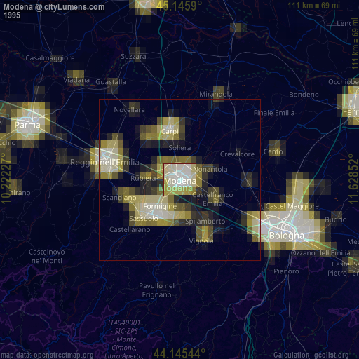
» NASA, Earths city lights 1995
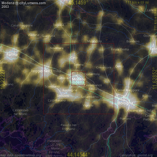
» NASA city lights 2003
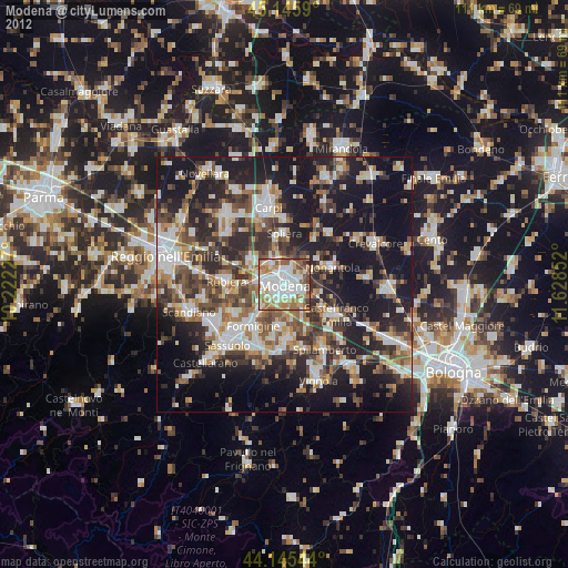
» Earth at Night: Flat Maps 2012, 2016