Rubiera night lights from space
Night Light of Rubiera (Emilia-Romagna) from space (Italy) Src. Average luminocity for 10x10km area is 47.3621% and for 50x50km: 37.2737%.
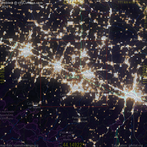
Analysis of Rubiera night lights 2016
Square area 10x10 km:
 4.24%
4.24%90-99
6.67%80-89
3.18%70-79
3.64%60-69
6.52%50-59
6.52%40-49
16.82%30-39
32.58%20-29
19.85%10-19
0%0-9
0%Square area 50x50 km:
6.1%90-99
7.43%80-89
3.55%70-79
3.28%60-69
3.94%50-59
5.07%40-49
6.55%30-39
7.97%20-29
16.02%10-19
22.28%0-9
17.81%Clear (daylight) street map image can be seen on geolist.org.
Map coordinates:
45° 8' 58.6" North, 10° 4' 34.6" East
44° 39' 5.7" North, 10° 46' 45.8" East
44° 8' 57.2" North, 11° 28' 57.1" East
Some cities around Rubiera sort by population:
• Modena
11.6 km =7.2 mi,  92°
92°
• Sassuolo
12.1 km =7.5 mi,  177°
177°
• Formigine
10.3 km =6.4 mi,  148°
148°
• Scandiano
8.9 km =5.5 mi,  228°
228°
• Casalgrande
8.2 km =5.1 mi,  205°
205°
• Campogalliano
6.8 km =4.2 mi,  52°
52°
• Veggia-Villalunga
10.3 km =6.4 mi,  190°
190°
• San Martino in Rio
9.1 km =5.7 mi,  2°
2°
3168820 (p: 12,001)
Sources (retrieved 2019-11-25):
» Earth at Night: Flat Maps 2012, 2016