Nonantola night lights from space
Night Light of Nonantola (Emilia-Romagna) from space (Italy) Src. Average luminocity for 10x10km area is 25.6697% and for 50x50km: 39.0683%.
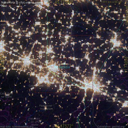
Analysis of Nonantola night lights 2016
Square area 10x10 km:
 1.06%
1.06%90-99
2.88%80-89
3.79%70-79
1.67%60-69
1.36%50-59
3.03%40-49
1.82%30-39
5.3%20-29
17.27%10-19
54.85%0-9
6.97%Square area 50x50 km:
7.04%90-99
8.03%80-89
3.55%70-79
3.03%60-69
3.81%50-59
4.92%40-49
6.38%30-39
7.49%20-29
15.28%10-19
30%0-9
10.47%Clear (daylight) street map image can be seen on geolist.org.
Map coordinates:
45° 10' 32.4" North, 10° 20' 5" East
44° 40' 40.3" North, 11° 2' 16.3" East
44° 10' 32.6" North, 11° 44' 27.5" East
Some cities around Nonantola sort by population:
• Modena
9.5 km =5.9 mi,  249°
249°
• Castelfranco Emilia
9.3 km =5.8 mi,  174°
174°
• San Giovanni in Persiceto
12.4 km =7.7 mi,  110°
110°
• Crevalcore
9.8 km =6.1 mi,  61°
61°
• Soliera
11.1 km =6.9 mi,  304°
304°
• Campogalliano
15.1 km =9.4 mi,  274°
274°
• Sant'Agata Bolognese
7.8 km =4.8 mi,  104°
104°
• Decima
15.6 km =9.7 mi,  76°
76°
3172217 (p: 10,867)
Sources (retrieved 2019-11-25):
» Earth at Night: Flat Maps 2012, 2016