Medicina-Buda night lights from space
Night Light of Medicina-Buda (Emilia-Romagna) from space (Italy) Src. Average luminocity for 10x10km area is 17.9746% and for 50x50km: 22.3781%.
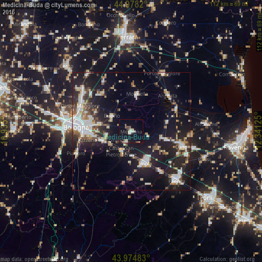
Analysis of Medicina-Buda night lights 2016
Square area 10x10 km:
 1.9%
1.9%90-99
5.24%80-89
1.11%70-79
0.95%60-69
1.59%50-59
2.38%40-49
1.11%30-39
1.43%20-29
0.16%10-19
25.24%0-9
58.89%Square area 50x50 km:
3.94%90-99
4.73%80-89
1.61%70-79
1.94%60-69
2.29%50-59
2.43%40-49
2.44%30-39
2.85%20-29
6.85%10-19
21.51%0-9
49.39%Clear (daylight) street map image can be seen on geolist.org.
Map coordinates:
44° 58' 41.5" North, 10° 56' 6" East
44° 28' 43.2" North, 11° 38' 17.2" East
43° 58' 29.4" North, 12° 20' 28.5" East
Some cities around Medicina-Buda sort by population:
• Imola
14.6 km =9.1 mi,  155°
155°
• Castel San Pietro Terme
9.8 km =6.1 mi,  205°
205°
• Molinella
15.6 km =9.7 mi,  8°
8°
• Massa Lombarda
14.9 km =9.3 mi,  103°
103°
• Castenaso
14 km =8.7 mi,  286°
286°
• Budrio
10.5 km =6.5 mi,  308°
308°
• Ozzano dell'Emilia
13.5 km =8.4 mi,  253°
253°
• Granarolo dell'Emilia e Viadagola
17.6 km =10.9 mi,  298°
298°
3173660 (p: 8,791)
Sources (retrieved 2019-11-25):
» Earth at Night: Flat Maps 2012, 2016