Ferrara night lights from space
Night Light of Ferrara (Emilia-Romagna) from space (Italy) Src. Average luminocity for 10x10km area is 61.727% and for 50x50km: 18.7729%.
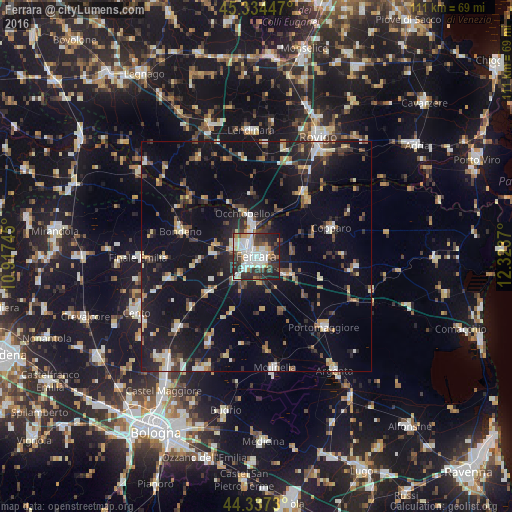
Analysis of Ferrara night lights 2016
Square area 10x10 km:
 17.3%
17.3%90-99
18.73%80-89
5.08%70-79
4.76%60-69
4.44%50-59
2.22%40-49
9.52%30-39
14.44%20-29
17.78%10-19
5.71%0-9
0%Square area 50x50 km:
2.02%90-99
2.87%80-89
1.71%70-79
1.8%60-69
1.76%50-59
2.2%40-49
3.05%30-39
3%20-29
5.5%10-19
17.7%0-9
58.39%Clear (daylight) street map image can be seen on geolist.org.
Map coordinates:
45° 20' 4.1" North, 10° 55' 2.8" East
44° 50' 16.9" North, 11° 37' 14.1" East
44° 20' 14.3" North, 12° 19' 25.3" East
Some cities around Ferrara sort by population:
• Molinella
24.8 km =15.4 mi,  171°
171°
• Finale Emilia
25.8 km =16 mi,  268°
268°
• Copparo
17.1 km =10.6 mi,  69°
69°
• Santa Maria Maddalena
7.2 km =4.5 mi,  351°
351°
• San Pietro in Casale
22.9 km =14.2 mi,  228°
228°
• Bondeno
17.1 km =10.6 mi,  289°
289°
• Portomaggiore
21.5 km =13.4 mi,  136°
136°
• Poggio Renatico
13.3 km =8.3 mi, 232°
3177090 (p: 92,802)
Sources (retrieved 2019-11-25):
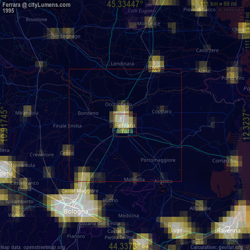
» NASA, Earths city lights 1995
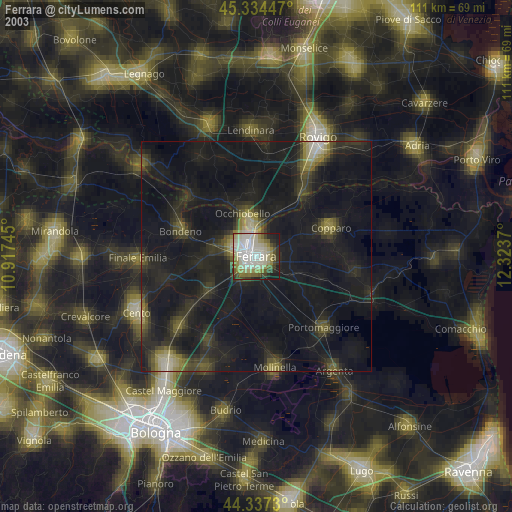
» NASA city lights 2003
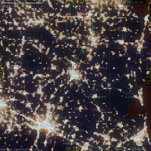
» Earth at Night: Flat Maps 2012, 2016