Poggio Renatico night lights from space
Night Light of Poggio Renatico (Emilia-Romagna) from space (Italy) Src. Average luminocity for 10x10km area is 18.3818% and for 50x50km: 20.9601%.
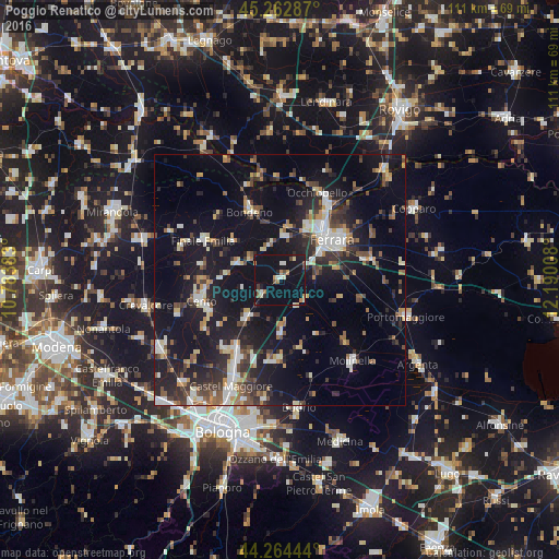
Analysis of Poggio Renatico night lights 2016
Square area 10x10 km:
 1.21%
1.21%90-99
3.33%80-89
1.36%70-79
1.36%60-69
2.73%50-59
1.36%40-49
2.42%30-39
0.45%20-29
2.12%10-19
27.88%0-9
55.76%Square area 50x50 km:
2.38%90-99
3.67%80-89
1.99%70-79
1.89%60-69
2.06%50-59
2.41%40-49
3.22%30-39
3.48%20-29
6.47%10-19
21.26%0-9
51.19%Clear (daylight) street map image can be seen on geolist.org.
Map coordinates:
45° 15' 46.3" North, 10° 47' 1.8" East
44° 45' 56.9" North, 11° 29' 13" East
44° 15' 52" North, 12° 11' 24.3" East
Some cities around Poggio Renatico sort by population:
• Ferrara
13.3 km =8.3 mi,  52°
52°
• Cento
16.2 km =10.1 mi,  256°
256°
• Finale Emilia
17 km =10.6 mi,  296°
296°
• Santa Maria Maddalena
17.9 km =11.1 mi,  31°
31°
• San Pietro in Casale
9.7 km =6 mi,  221°
221°
• Bondeno
14.9 km =9.3 mi,  337°
337°
• Pieve di Cento
15.2 km =9.4 mi,  247°
247°
• San Giorgio di Piano
15.9 km =9.9 mi,  213°
213°
3170442 (p: 5,306)
Sources (retrieved 2019-11-25):
» Earth at Night: Flat Maps 2012, 2016