Copparo night lights from space
Night Light of Copparo (Emilia-Romagna) from space (Italy) Src. Average luminocity for 10x10km area is 15.627% and for 50x50km: 16.1573%.
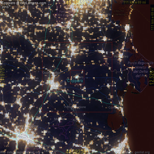
Analysis of Copparo night lights 2016
Square area 10x10 km:
 2.54%
2.54%90-99
1.75%80-89
0.16%70-79
0%60-69
3.33%50-59
2.06%40-49
2.54%30-39
1.9%20-29
3.65%10-19
2.86%0-9
79.21%Square area 50x50 km:
1.77%90-99
2.56%80-89
1.51%70-79
1.6%60-69
1.49%50-59
1.99%40-49
2.78%30-39
2.88%20-29
4.94%10-19
13.05%0-9
65.44%Clear (daylight) street map image can be seen on geolist.org.
Map coordinates:
45° 23' 18.9" North, 11° 7' 11.1" East
44° 53' 33.5" North, 11° 49' 22.3" East
44° 23' 32.5" North, 12° 31' 33.6" East
Some cities around Copparo sort by population:
• Ferrara
17.1 km =10.6 mi,  249°
249°
• Rovigo
19.9 km =12.4 mi,  352°
352°
• Adria
25.7 km =16 mi,  45°
45°
• Santa Maria Maddalena
17.1 km =10.6 mi,  273°
273°
• Lendinara
27.3 km =17 mi,  320°
320°
• Portomaggiore
21.7 km =13.5 mi,  183°
183°
• Codigoro
23.7 km =14.7 mi,  106°
106°
• Villadose
20.8 km =12.9 mi,  16°
16°
3178137 (p: 8,903)
Sources (retrieved 2019-11-25):
» Earth at Night: Flat Maps 2012, 2016