Dalmine night lights from space
Night Light of Dalmine (Lombardy) from space (Italy) Src. Average luminocity for 10x10km area is 89.6439% and for 50x50km: 56.3917%.
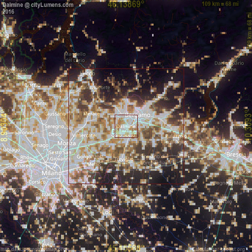
Analysis of Dalmine night lights 2016
Square area 10x10 km:
 35%
35%90-99
29.7%80-89
9.24%70-79
11.36%60-69
14.09%50-59
0.61%40-49
0%30-39
0%20-29
0%10-19
0%0-9
0%Square area 50x50 km:
13.16%90-99
13.94%80-89
5.45%70-79
6.69%60-69
8.16%50-59
7.7%40-49
7.03%30-39
8.23%20-29
11.44%10-19
11.75%0-9
6.46%Clear (daylight) street map image can be seen on geolist.org.
Map coordinates:
46° 8' 19.3" North, 8° 54' 10.9" East
45° 38' 57.6" North, 9° 36' 22.2" East
45° 9' 20.4" North, 10° 18' 33.5" East
Some cities around Dalmine sort by population:
• Stezzano
3.6 km =2.2 mi,  89°
89°
• Osio Sotto
3.9 km =2.4 mi,  199°
199°
• Treviolo
2.7 km =1.7 mi,  9°
9°
• Curno
4.4 km =2.7 mi,  2°
2°
• Verdello
5.4 km =3.4 mi,  161°
161°
• Azzano San Paolo
5.3 km =3.3 mi,  79°
79°
• Bonate Sopra
5.1 km =3.2 mi,  314°
314°
• Bonate Sotto
4.2 km =2.6 mi,  299°
299°
3177650 (p: 22,881)
Sources (retrieved 2019-11-25):
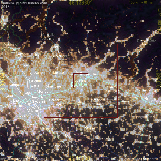
» Earth at Night: Flat Maps 2012, 2016