Bonate Sotto night lights from space
Night Light of Bonate Sotto (Lombardy) from space (Italy) Src. Average luminocity for 10x10km area is 86.3818% and for 50x50km: 58.2863%.
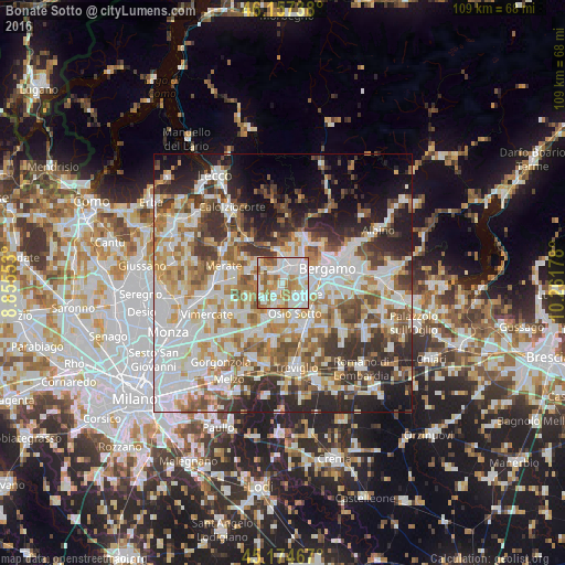
Analysis of Bonate Sotto night lights 2016
Square area 10x10 km:
 30.45%
90-99
29.7%80-89
6.06%70-79
10.76%60-69
14.7%50-59
7.58%40-49
0.76%30-39
0%20-29
0%10-19
0%0-9
0%Square area 50x50 km:
15.77%90-99
14.11%80-89
5.6%70-79
7.21%60-69
8.14%50-59
7.14%40-49
6.7%30-39
7.61%20-29
9.72%10-19
9.18%0-9
8.83%Clear (daylight) street map image can be seen on geolist.org.
Map coordinates:
46° 9' 26.6" North, 8° 51' 19.9" East
45° 40' 5.4" North, 9° 33' 31.1" East
45° 10' 28.8" North, 10° 15' 42.4" East
Some cities around Bonate Sotto sort by population:
• Dalmine
4.2 km =2.6 mi,  119°
119°
• Ponte San Pietro
4.9 km =3 mi,  30°
30°
• Treviolo
4.2 km =2.6 mi,  81°
81°
• Brembate di Sopra
5.6 km =3.5 mi,  16°
16°
• Terno d'Isola
2.9 km =1.8 mi,  311°
311°
• Curno
4.5 km =2.8 mi,  59°
59°
• Mozzo
5.2 km =3.2 mi,  48°
48°
• Bottanuco
5 km =3.1 mi,  230°
230°
6534958 (p: 6,236)
Sources (retrieved 2019-11-25):
» Earth at Night: Flat Maps 2012, 2016