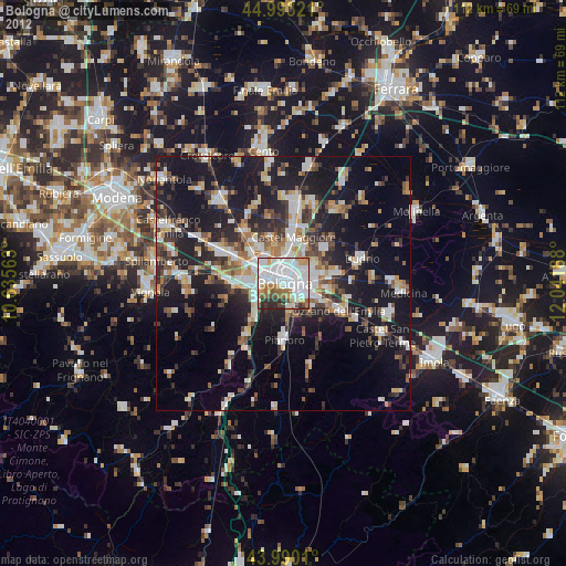
Bologna night lights from space
Night Light of Bologna (Emilia-Romagna) from space (Italy) Src. Average luminocity for 10x10km area is 81.2651% and for 50x50km: 24.8434%.

Analysis of Bologna night lights 2016
Square area 10x10 km:
 39.84%
90-99
22.22%80-89
3.65%70-79
3.65%60-69
6.03%50-59
6.98%40-49
5.4%30-39
8.1%20-29
4.13%10-19
0%0-9
0%Square area 50x50 km:
4.23%90-99
5.1%80-89
2.13%70-79
2.23%60-69
2.44%50-59
2.64%40-49
3.1%30-39
4%20-29
8.42%10-19
23.73%0-9
41.98%Clear (daylight) street map image can be seen on geolist.org.
Map coordinates:
44° 59' 35.6" North, 10° 38' 8.3" East
44° 29' 37.7" North, 11° 20' 19.5" East
43° 59' 24.4" North, 12° 2' 30.8" East
Some cities around Bologna sort by population:
• Casalecchio di Reno
5.4 km =3.4 mi,  248°
248°
• San Lazzaro
6.1 km =3.8 mi,  115°
115°
• Castel Maggiore
9.4 km =5.8 mi,  10°
10°
• Zola Predosa
9.6 km =6 mi,  267°
267°
• Progresso
8.6 km =5.3 mi, 13°
• Castenaso
10.5 km =6.5 mi,  77°
77°
• Calderara di Reno
9.4 km =5.8 mi,  325°
325°
• Rastignano-Carteria di Sesto
6.6 km =4.1 mi,  167°
167°
3181928 (p: 366,133)
Sources (retrieved 2019-11-25):
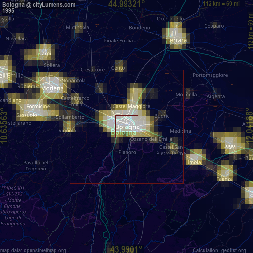
» NASA, Earths city lights 1995
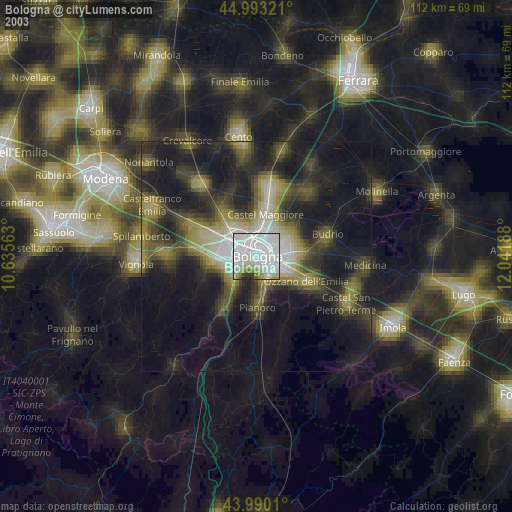
» NASA city lights 2003
» Earth at Night: Flat Maps 2012, 2016