Casalecchio di Reno night lights from space
Night Light of Casalecchio di Reno (Emilia-Romagna) from space (Italy) Src. Average luminocity for 10x10km area is 58.3238% and for 50x50km: 25.6845%.
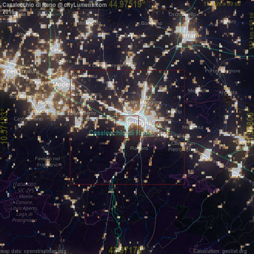
Analysis of Casalecchio di Reno night lights 2016
Square area 10x10 km:
 18.73%
90-99
14.92%80-89
4.29%70-79
2.06%60-69
4.76%50-59
6.51%40-49
5.87%30-39
11.43%20-29
21.59%10-19
9.84%0-9
0%Square area 50x50 km:
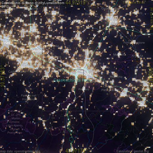
4.26%90-99
5.21%80-89
2.33%70-79
2.29%60-69
2.73%50-59
2.78%40-49
3.39%30-39
4.57%20-29
10.17%10-19
20.91%0-9
41.37%Clear (daylight) street map image can be seen on geolist.org.
Map coordinates:
44° 58' 30.7" North, 10° 34' 18.6" East
44° 28' 32.3" North, 11° 16' 29.8" East
43° 58' 18.3" North, 11° 58' 41.1" East
Some cities around Casalecchio di Reno sort by population:
• Bologna
5.4 km =3.4 mi,  68°
68°
• San Lazzaro
10.6 km =6.6 mi,  93°
93°
• Zola Predosa
4.8 km =3 mi,  289°
289°
• Anzola dell'Emilia
9.2 km =5.7 mi,  323°
323°
• Pianoro
11 km =6.8 mi,  150°
150°
• Calderara di Reno
9.7 km =6 mi,  358°
358°
• Sasso Marconi
8.5 km =5.3 mi,  192°
192°
• Rastignano-Carteria di Sesto
7.8 km =4.8 mi,  123°
123°
3180224 (p: 33,789)
Sources (retrieved 2019-11-25):
» Earth at Night: Flat Maps 2012, 2016