Bazzano night lights from space
Night Light of Bazzano (Emilia-Romagna) from space (Italy) Src. Average luminocity for 10x10km area is 33.8476% and for 50x50km: 31.1882%.
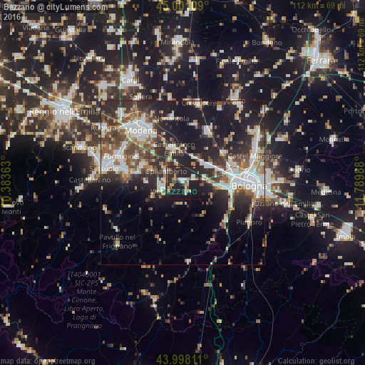
Analysis of Bazzano night lights 2016
Square area 10x10 km:
 2.22%
2.22%90-99
6.03%80-89
3.33%70-79
3.97%60-69
4.76%50-59
2.86%40-49
4.76%30-39
3.33%20-29
26.19%10-19
40.16%0-9
2.38%Square area 50x50 km:
6.09%90-99
6.56%80-89
2.74%70-79
2.56%60-69
3.48%50-59
4.09%40-49
4.93%30-39
5.64%20-29
10.65%10-19
18.22%0-9
35.03%Clear (daylight) street map image can be seen on geolist.org.
Map coordinates:
45° 0' 3.9" North, 10° 23' 1.1" East
44° 30' 6.3" North, 11° 5' 12.3" East
43° 59' 53.2" North, 11° 47' 23.6" East
Some cities around Bazzano sort by population:
• Casalecchio di Reno
15.2 km =9.4 mi,  101°
101°
• Vignola
6.3 km =3.9 mi,  251°
251°
• Castelfranco Emilia
10.7 km =6.6 mi,  344°
344°
• Zola Predosa
10.5 km =6.5 mi, 97°
• Anzola dell'Emilia
10.4 km =6.5 mi,  64°
64°
• Spilamberto
6.5 km =4 mi,  301°
301°
• Castelnuovo Rangone
13.3 km =8.3 mi,  293°
293°
• Calderara di Reno
16.1 km =10 mi, 64°
3182260 (p: 6,131)
Sources (retrieved 2019-11-25):
» Earth at Night: Flat Maps 2012, 2016