Sūsangerd night lights from space
Night Light of Sūsangerd (Khuzestan) from space (Iran) Src. Average luminocity for 10x10km area is 38.1101% and for 50x50km: 6.1843%.
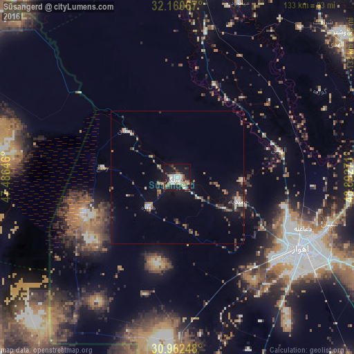
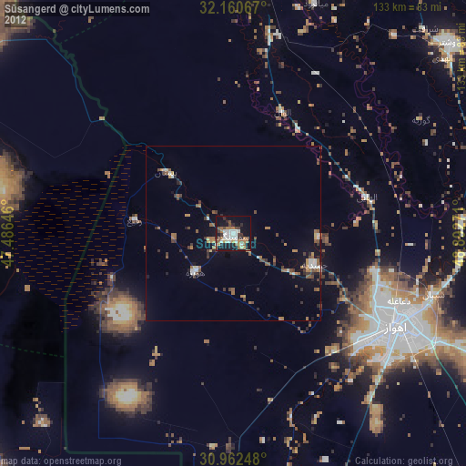
Analysis of Sūsangerd night lights 2016
Square area 10x10 km:
 10.84%
90-99
5.94%80-89
0.52%70-79
1.57%60-69
8.22%50-59
5.42%40-49
1.92%30-39
6.47%20-29
9.27%10-19
38.81%0-9
11.01%Square area 50x50 km:
1.02%90-99
0.65%80-89
0.05%70-79
0.45%60-69
1.11%50-59
1.21%40-49
0.61%30-39
0.95%20-29
1.57%10-19
5.3%0-9
87.07%Clear (daylight) street map image can be seen on geolist.org.
Map coordinates:
32° 9' 38.4" North, 47° 29' 11.3" East
31° 33' 48.6" North, 48° 11' 22.5" East
30° 57' 44.9" North, 48° 53' 33.8" East
Some cities around Sūsangerd sort by population:
• Al Başrah al Qadīmah, IQ
123.2 km =76.6 mi,  196°
196°
• Ahvaz
54.2 km =33.7 mi,  120°
120°
• Al ‘Amārah, IQ
103.4 km =64.2 mi,  287°
287°
• Masjed Soleymān
113.2 km =70.3 mi,  68°
68°
• Al Hārithah, IQ
116.2 km =72.2 mi, 200°
• Shūshtar
82.5 km =51.3 mi,  49°
49°
• Shūsh
70.3 km =43.7 mi,  4°
4°
• Shādegān
111.3 km =69.2 mi,  156°
156°
137268 (p: 41,443)
Sources (retrieved 2019-11-25):
» Earth at Night: Flat Maps 2012, 2016