Qazvin night lights from space
Night Light of Qazvin (Qazvīn) from space (Iran) Src. Average luminocity for 10x10km area is 70.6469% and for 50x50km: 17.3386%.
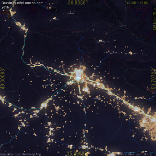

Analysis of Qazvin night lights 2016
Square area 10x10 km:
 16.96%
90-99
13.46%80-89
3.85%70-79
23.43%60-69
7.69%50-59
12.06%40-49
8.74%30-39
11.89%20-29
1.92%10-19
0%0-9
0%Square area 50x50 km:
1.62%90-99
1.49%80-89
0.79%70-79
6.01%60-69
2.09%50-59
2.37%40-49
2.47%30-39
3.3%20-29
5.53%10-19
11.26%0-9
63.07%Clear (daylight) street map image can be seen on geolist.org.
Map coordinates:
36° 50' 1" North, 49° 18' 3.5" East
36° 16' 7.6" North, 50° 0' 14.8" East
35° 41' 59.4" North, 50° 42' 26" East
Some cities around Qazvin sort by population:
• Naz̧arābād
64.4 km =40 mi,  122°
122°
• Alvand
10.4 km =6.5 mi,  148°
148°
• Alvand
75.2 km =46.7 mi,  274°
274°
• Tākestān
35.4 km =22 mi,  231°
231°
• Abhar
71.8 km =44.6 mi,  259°
259°
• Ābyek
53.9 km =33.5 mi,  114°
114°
• Khorramdarreh
72.9 km =45.3 mi, 264°
• Pādegān-e Manjīl
74.3 km =46.2 mi,  315°
315°
119505 (p: 333,635)
Sources (retrieved 2019-11-25):
» NASA, Earths city lights 1995
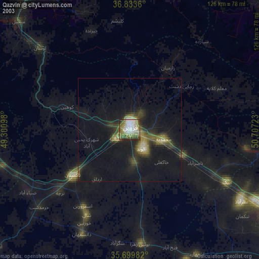
» NASA city lights 2003
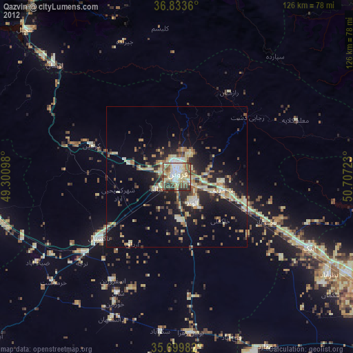
» Earth at Night: Flat Maps 2012, 2016