Hashtrūd night lights from space
Night Light of Hashtrūd (East Azerbaijan) from space (Iran) Src. Average luminocity for 10x10km area is 14.4562% and for 50x50km: 1.4617%.
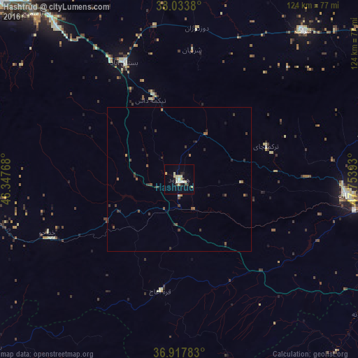
Analysis of Hashtrūd night lights 2016
Square area 10x10 km:
 0.97%
0.97%90-99
3.08%80-89
4.06%70-79
1.79%60-69
0.49%50-59
0%40-49
0.32%30-39
2.11%20-29
2.44%10-19
3.41%0-9
81.33%Square area 50x50 km:
0.04%90-99
0.16%80-89
0.2%70-79
0.13%60-69
0.23%50-59
0.24%40-49
0.23%30-39
0.59%20-29
0.4%10-19
0.29%0-9
97.49%Clear (daylight) street map image can be seen on geolist.org.
Map coordinates:
38° 2' 1.7" North, 46° 20' 51.6" East
37° 28' 40.4" North, 47° 3' 2.9" East
36° 55' 4.2" North, 47° 45' 14.1" East
Some cities around Hashtrūd sort by population:
• Tabriz
94.5 km =58.7 mi,  315°
315°
• Būkān
130 km =80.8 mi,  215°
215°
• Mīāndoāb
100.9 km =62.7 mi,  235°
235°
• Ahar
111.1 km =69 mi,  0°
0°
• Bonāb
89.2 km =55.4 mi,  260°
260°
• Takāb
119.9 km =74.5 mi,  177°
177°
• Shāhīn Dezh
98.6 km =61.3 mi,  205°
205°
• ‘Ajab Shīr
102 km =63.4 mi,  269°
269°
142554 (p: 16,888)
Sources (retrieved 2019-11-25):
» Earth at Night: Flat Maps 2012, 2016