Ahar night lights from space
Night Light of Ahar (East Azerbaijan) from space (Iran) Src. Average luminocity for 10x10km area is 28.086% and for 50x50km: 2.0907%.
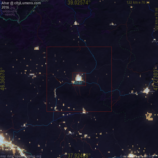
Analysis of Ahar night lights 2016
Square area 10x10 km:
 6.33%
6.33%90-99
6.01%80-89
1.95%70-79
4.71%60-69
0.65%50-59
1.79%40-49
3.08%30-39
0.81%20-29
3.73%10-19
37.5%0-9
33.44%Square area 50x50 km:
0.27%90-99
0.29%80-89
0.18%70-79
0.36%60-69
0.14%50-59
0.24%40-49
0.3%30-39
0.3%20-29
0.42%10-19
1.75%0-9
95.76%Clear (daylight) street map image can be seen on geolist.org.
Map coordinates:
39° 1' 32.7" North, 46° 22' 0.4" East
38° 28' 38.6" North, 47° 4' 11.6" East
37° 55' 29.5" North, 47° 46' 22.9" East
Some cities around Ahar sort by population:
• Tabriz
81 km =50.3 mi,  236°
236°
• Ardabīl
109.6 km =68.1 mi,  103°
103°
• Kapan, AM
99.5 km =61.8 mi,  324°
324°
• Ordubad, AZ
102.8 km =63.9 mi,  297°
297°
• Jebrail, AZ
102.6 km =63.8 mi,  357°
357°
• Zangilan, AZ
76.2 km =47.3 mi,  332°
332°
• Qubadlı, AZ
105.2 km =65.4 mi,  336°
336°
• Mincivan, AZ
68.4 km =42.5 mi, 333°
144616 (p: 94,348)
Sources (retrieved 2019-11-25):
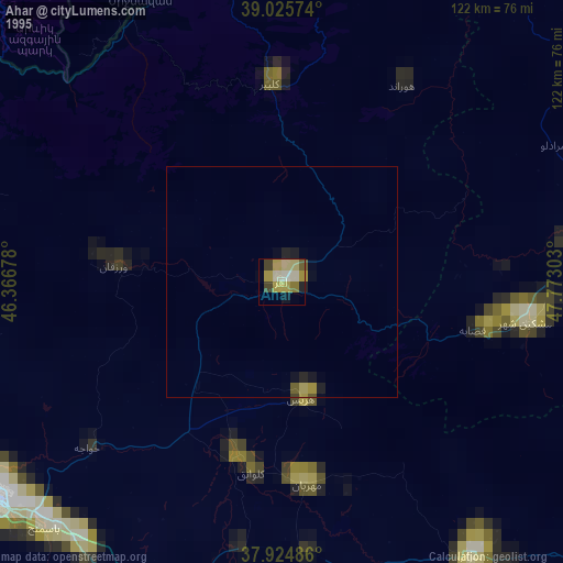
» NASA, Earths city lights 1995
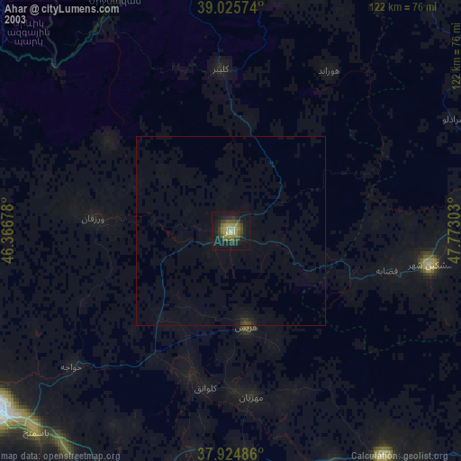
» NASA city lights 2003
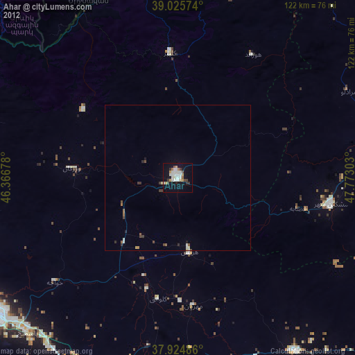
» Earth at Night: Flat Maps 2012, 2016