Būkān night lights from space
Night Light of Būkān (West Azerbaijan) from space (Iran) Src. Average luminocity for 10x10km area is 43.4652% and for 50x50km: 2.6758%.
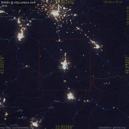
Analysis of Būkān night lights 2016
Square area 10x10 km:
 8.97%
8.97%90-99
11.9%80-89
5.49%70-79
4.03%60-69
2.93%50-59
2.01%40-49
5.68%30-39
2.93%20-29
14.1%10-19
36.63%0-9
5.31%Square area 50x50 km:
0.34%90-99
0.47%80-89
0.4%70-79
0.2%60-69
0.28%50-59
0.16%40-49
0.38%30-39
0.33%20-29
0.7%10-19
2.45%0-9
94.27%Clear (daylight) street map image can be seen on geolist.org.
Map coordinates:
37° 5' 2.4" North, 45° 30' 20.8" East
36° 31' 15.6" North, 46° 12' 32" East
35° 57' 14" North, 46° 54' 43.3" East
Some cities around Būkān sort by population:
• Mahābād
51.1 km =31.8 mi,  301°
301°
• Saqqez
30.7 km =19.1 mi,  169°
169°
• Mīāndoāb
50.3 km =31.3 mi,  349°
349°
• Bāneh
65 km =40.4 mi,  206°
206°
• Bonāb
92.1 km =57.2 mi, 351°
• Naqadeh
87.6 km =54.4 mi, 303°
• Takāb
82 km =51 mi,  99°
99°
• Shāhīn Dezh
36.5 km =22.7 mi,  61°
61°
139889 (p: 213,331)
Sources (retrieved 2019-11-25):
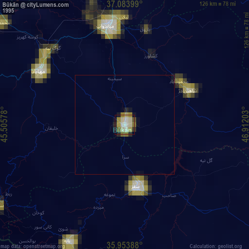
» NASA, Earths city lights 1995
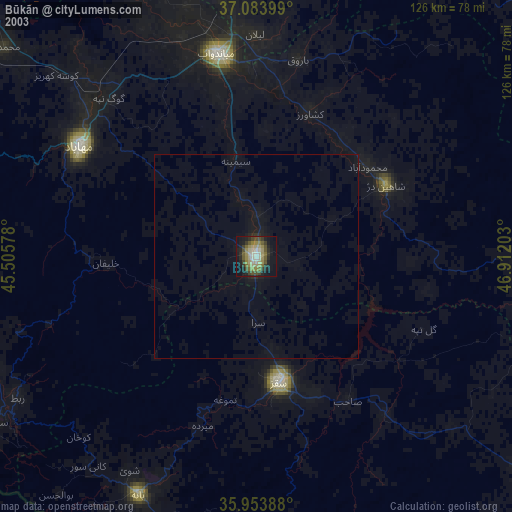
» NASA city lights 2003
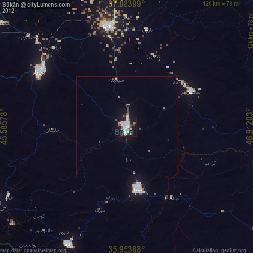
» Earth at Night: Flat Maps 2012, 2016