Āmol night lights from space
Night Light of Āmol (Māzandarān) from space (Iran) Src. Average luminocity for 10x10km area is 72.2839% and for 50x50km: 25.1923%.
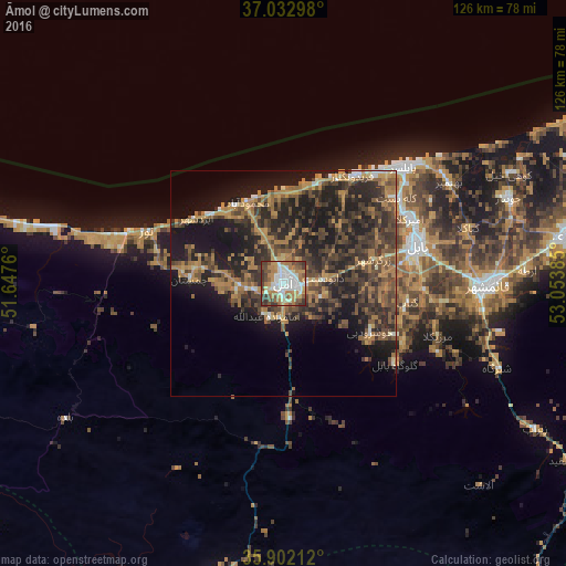
Analysis of Āmol night lights 2016
Square area 10x10 km:
 15.57%
90-99
18.68%80-89
6.23%70-79
10.62%60-69
18.32%50-59
10.26%40-49
9.71%30-39
10.44%20-29
0.18%10-19
0%0-9
0%Square area 50x50 km:
1.09%90-99
1.6%80-89
1.28%70-79
4.16%60-69
7.06%50-59
4.32%40-49
7.12%30-39
7.75%20-29
10.12%10-19
18.4%0-9
37.1%Clear (daylight) street map image can be seen on geolist.org.
Map coordinates:
37° 1' 58.7" North, 51° 38' 51.4" East
36° 28' 10.6" North, 52° 21' 2.6" East
35° 54' 7.6" North, 53° 3' 13.9" East
Some cities around Āmol sort by population:
• Sari
64.2 km =39.9 mi,  80°
80°
• Bābol
30.7 km =19.1 mi,  72°
72°
• Chālūs
85.6 km =53.2 mi,  283°
283°
• Nekā
87.1 km =54.1 mi, 76°
• Bābolsar
37.7 km =23.4 mi,  46°
46°
• Nowshahr
78.9 km =49 mi, 284°
• Fereydūnkenār
28.6 km =17.8 mi,  32°
32°
• Jūybār
53.7 km =33.4 mi, 69°
143534 (p: 199,382)
Sources (retrieved 2019-11-25):
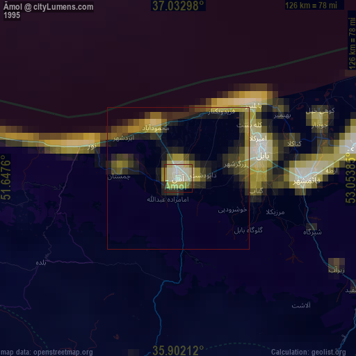
» NASA, Earths city lights 1995
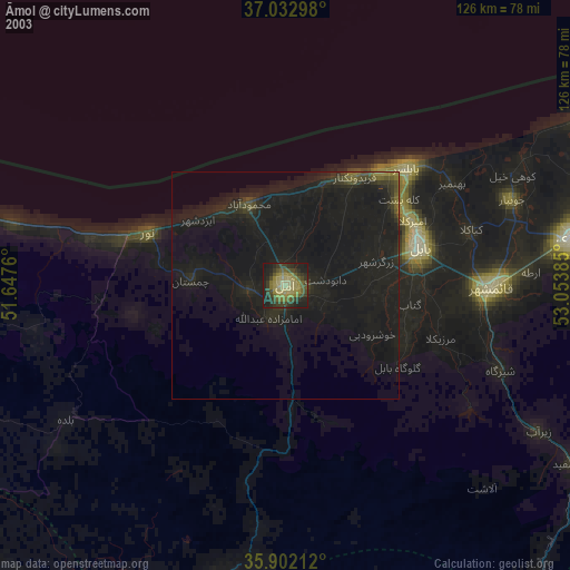
» NASA city lights 2003
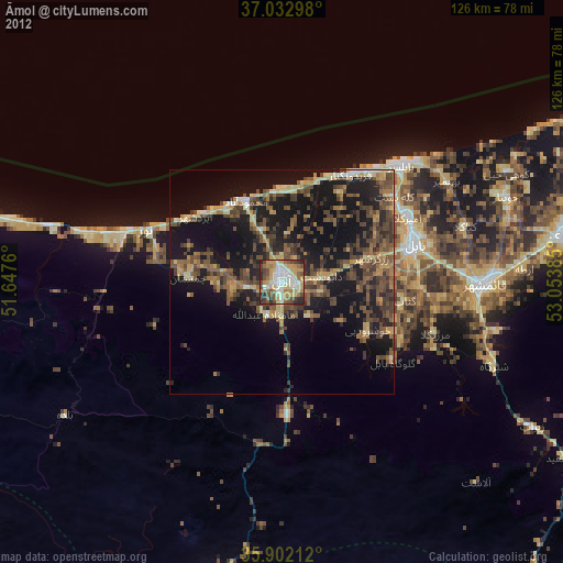
» Earth at Night: Flat Maps 2012, 2016