Tehran night lights from space
Night Light of Tehran (Tehrān) from space (Iran) Src. Average luminocity for 10x10km area is 100% and for 50x50km: 63.4269%.
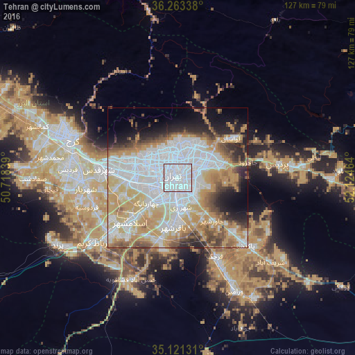
Analysis of Tehran night lights 2016
Square area 10x10 km:
 100%
100%90-99
0%80-89
0%70-79
0%60-69
0%50-59
0%40-49
0%30-39
0%20-29
0%10-19
0%0-9
0%Square area 50x50 km:
25.08%90-99
10.95%80-89
6.63%70-79
13.17%60-69
5.51%50-59
4.81%40-49
4.73%30-39
3.41%20-29
6.03%10-19
6.97%0-9
12.71%Clear (daylight) street map image can be seen on geolist.org.
Map coordinates:
36° 15' 48.2" North, 50° 43' 6.2" East
35° 41' 39.8" North, 51° 25' 17.4" East
35° 7' 16.7" North, 52° 7' 28.7" East
Fantastic image of Tehran from space taken by astronauts [src2], but I don't have information about it's orientation, scale or angle. If necessary, it was rotated manually, so North points approximately to upper direction. Click to zoom in:

Some cities around Tehran sort by population:
• Karaj
41.7 km =25.9 mi,  291°
291°
• Qarchak
32.7 km =20.3 mi,  154°
154°
• Shahre Jadide Andisheh
36.4 km =22.6 mi,  267°
267°
• Robāţ Karīm
38.5 km =23.9 mi,  232°
232°
• Shahrīār
33.1 km =20.6 mi,  263°
263°
• Malārd
40.3 km =25 mi, 265°
• Sharīfābād
44.3 km =27.5 mi,  132°
132°
• Shahrak-e Emām Ḩasan
23.9 km =14.9 mi,  196°
196°
112931 (p: 7,153,309)
Sources (retrieved 2019-11-25):
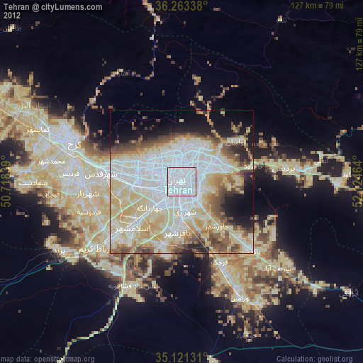
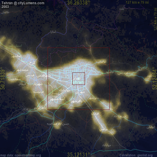
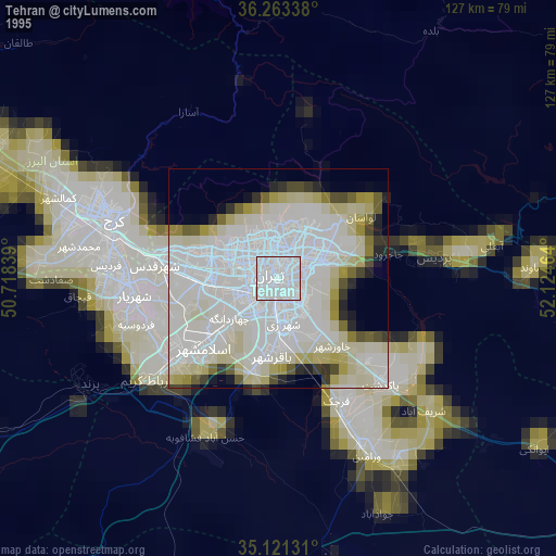
» NASA, Earths city lights 1995
» NASA city lights 2003
» Earth at Night: Flat Maps 2012, 2016
Src.2: Tim Kopra, Twitter/@astro_tim, 2016-04-28