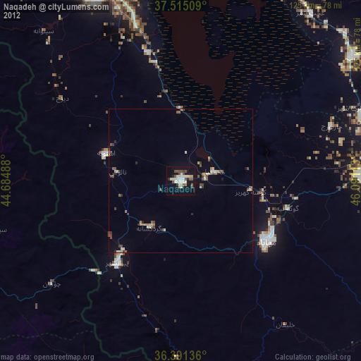
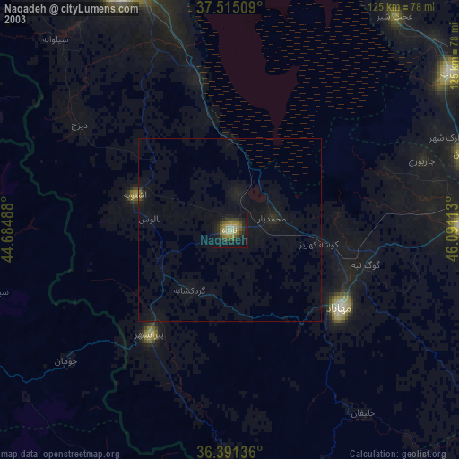
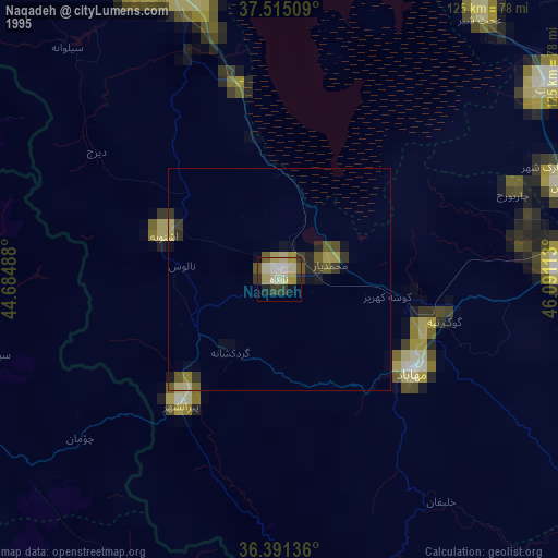
Naqadeh night lights from space
Night Light of Naqadeh (West Azerbaijan) from space (Iran) Src. Average luminocity for 10x10km area is 30.4578% and for 50x50km: 3.872%.
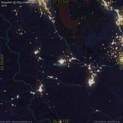
Analysis of Naqadeh night lights 2016
Square area 10x10 km:
 4.22%
4.22%90-99
7.63%80-89
3.73%70-79
2.92%60-69
2.27%50-59
1.95%40-49
2.44%30-39
5.52%20-29
4.71%10-19
41.88%0-9
22.73%Square area 50x50 km:
0.22%90-99
0.56%80-89
0.59%70-79
0.5%60-69
0.26%50-59
0.39%40-49
0.64%30-39
0.92%20-29
0.46%10-19
3.3%0-9
92.16%Clear (daylight) street map image can be seen on geolist.org.
Map coordinates:
37° 30' 54.3" North, 44° 41' 5.6" East
36° 57' 19.1" North, 45° 23' 16.8" East
36° 23' 28.9" North, 46° 5' 28.1" East
Some cities around Naqadeh sort by population:
• Orūmīyeh
71.9 km =44.7 mi,  337°
337°
• Mahābād
36.6 km =22.7 mi,  125°
125°
• Mīāndoāb
64.1 km =39.8 mi,  88°
88°
• Bonāb
73.1 km =45.4 mi,  54°
54°
• Piranshahr
35.8 km =22.2 mi,  217°
217°
• Oshnavīyeh
27.4 km =17 mi,  290°
290°
• ‘Ajab Shīr
73.4 km =45.6 mi,  37°
37°
• Şemdinli, TR
82 km =51 mi,  298°
298°
122698 (p: 73,528)
Sources (retrieved 2019-11-25):
» NASA, Earths city lights 1995
» NASA city lights 2003
» Earth at Night: Flat Maps 2012, 2016