Bāneh night lights from space
Night Light of Bāneh (Kordestān) from space (Iran) Src. Average luminocity for 10x10km area is 32.3718% and for 50x50km: 1.7779%.
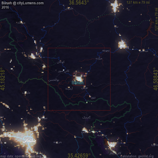
Analysis of Bāneh night lights 2016
Square area 10x10 km:
 3.66%
3.66%90-99
9.71%80-89
2.01%70-79
2.75%60-69
3.11%50-59
2.2%40-49
4.03%30-39
7.51%20-29
3.85%10-19
43.22%0-9
17.95%Square area 50x50 km:
0.14%90-99
0.4%80-89
0.16%70-79
0.1%60-69
0.23%50-59
0.12%40-49
0.29%30-39
0.38%20-29
0.27%10-19
1.81%0-9
96.1%Clear (daylight) street map image can be seen on geolist.org.
Map coordinates:
36° 33' 51.5" North, 45° 10' 55.8" East
35° 59' 51" North, 45° 53' 7.1" East
35° 25' 35.7" North, 46° 35' 18.3" East
Some cities around Bāneh sort by population:
• As Sulaymānīyah, IQ
63.1 km =39.2 mi,  220°
220°
• Būkān
65 km =40.4 mi,  26°
26°
• Mahābād
86.4 km =53.7 mi,  350°
350°
• Saqqez
44.8 km =27.8 mi,  51°
51°
• Marīvān
59.7 km =37.1 mi,  153°
153°
• Ḩalabjah, IQ
91.6 km =56.9 mi,  174°
174°
• Shāhīn Dezh
97.3 km =60.5 mi,  38°
38°
• Baynjiwayn, IQ
42.3 km =26.3 mi, 172°
141584 (p: 104,799)
Sources (retrieved 2019-11-25):
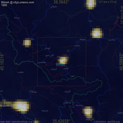
» NASA, Earths city lights 1995
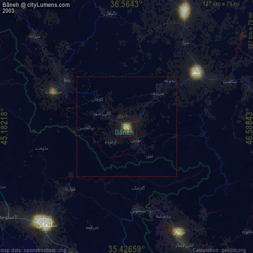
» NASA city lights 2003
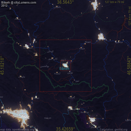
» Earth at Night: Flat Maps 2012, 2016