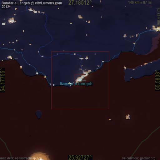
Bandar-e Lengeh night lights from space
Night Light of Bandar-e Lengeh (Hormozgan) from space (Iran) Src. Average luminocity for 10x10km area is 36.4981% and for 50x50km: 4.2468%.
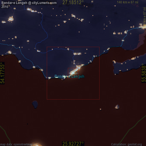
Analysis of Bandar-e Lengeh night lights 2016
Square area 10x10 km:
 6.44%
6.44%90-99
6.63%80-89
4.92%70-79
1.89%60-69
3.41%50-59
6.06%40-49
5.49%30-39
5.49%20-29
11.36%10-19
34.47%0-9
13.83%Square area 50x50 km:
0.46%90-99
0.6%80-89
0.4%70-79
0.37%60-69
0.75%50-59
0.64%40-49
0.56%30-39
0.56%20-29
0.99%10-19
3.34%0-9
91.34%Clear (daylight) street map image can be seen on geolist.org.
Map coordinates:
27° 11' 6.4" North, 54° 10' 39.2" East
26° 33' 28.5" North, 54° 52' 50.4" East
25° 55' 38.2" North, 55° 35' 1.7" East
Some cities around Bandar-e Lengeh sort by population:
• Sharjah, AE
145.7 km =90.5 mi,  158°
158°
• Ajman City, AE
141.8 km =88.1 mi, 155°
• Ras Al Khaimah City, AE
136.2 km =84.6 mi,  128°
128°
• Umm Al Quwain City, AE
129.4 km =80.4 mi,  148°
148°
• Gerāsh
143.9 km =89.4 mi,  329°
329°
• Qeshm
144.6 km =89.9 mi,  72°
72°
• Kīsh
85.7 km =53.3 mi,  269°
269°
• Khasab, OM
142.5 km =88.5 mi,  107°
107°
141665 (p: 22,768)
Sources (retrieved 2019-11-25):
» Earth at Night: Flat Maps 2012, 2016