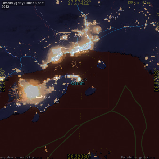
Qeshm night lights from space
Night Light of Qeshm (Hormozgan) from space (Iran) Src. Average luminocity for 10x10km area is 40.9226% and for 50x50km: 14.5645%.
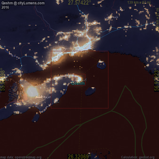
Analysis of Qeshm night lights 2016
Square area 10x10 km:
 8.33%
8.33%90-99
7.14%80-89
1.98%70-79
2.98%60-69
9.92%50-59
7.54%40-49
5.16%30-39
6.15%20-29
9.13%10-19
28.37%0-9
13.29%Square area 50x50 km:
2.15%90-99
2.2%80-89
0.93%70-79
1.08%60-69
3.45%50-59
2.8%40-49
1.71%30-39
2.83%20-29
3.62%10-19
10.95%0-9
68.29%Clear (daylight) street map image can be seen on geolist.org.
Map coordinates:
27° 34' 27.2" North, 55° 33' 57.5" East
26° 56' 57.1" North, 56° 16' 8.8" East
26° 19' 14.5" North, 56° 58' 20" East
Some cities around Qeshm sort by population:
• Bandar Abbas
26.4 km =16.4 mi,  2°
2°
• Ras Al Khaimah City, AE
133 km =82.6 mi,  194°
194°
• Mīnāb
83.5 km =51.9 mi,  75°
75°
• Umm Al Quwain City, AE
169.6 km =105.4 mi,  204°
204°
• Dibba Al-Fujairah, AE
150.9 km =93.8 mi,  180°
180°
• Dibba Al-Hisn, AE
147.8 km =91.8 mi, 179°
• Bandar-e Lengeh
144.6 km =89.9 mi,  252°
252°
• Khasab, OM
85.6 km =53.2 mi, 181°
119374 (p: 25,000)
Sources (retrieved 2019-11-25):
» Earth at Night: Flat Maps 2012, 2016