Ras Al Khaimah City night lights from space
Night Light of Ras Al Khaimah City (Raʼs al Khaymah) from space (United Arab Emirates) Src. Average luminocity for 10x10km area is 76.6686% and for 50x50km: 25.7921%.
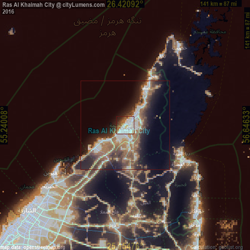
Analysis of Ras Al Khaimah City night lights 2016
Square area 10x10 km:
 34.85%
90-99
20.45%80-89
2.84%70-79
6.25%60-69
7.58%50-59
6.44%40-49
6.63%30-39
4.55%20-29
4.17%10-19
5.68%0-9
0.57%Square area 50x50 km:
4.46%90-99
4.83%80-89
1.75%70-79
2.11%60-69
5.91%50-59
5.46%40-49
4.29%30-39
4.41%20-29
6.26%10-19
9.66%0-9
50.85%Clear (daylight) street map image can be seen on geolist.org.
Map coordinates:
26° 25' 15.3" North, 55° 14' 24.3" East
25° 47' 22.3" North, 55° 56' 35.5" East
25° 9' 17.1" North, 56° 38' 46.8" East
Some cities around Ras Al Khaimah City sort by population:
• Sharjah
73.3 km =45.5 mi,  226°
226°
• Ajman City
63.5 km =39.5 mi, 227°
• Umm Al Quwain City
46.2 km =28.7 mi,  237°
237°
• Khawr Fakkān
64.8 km =40.3 mi,  141°
141°
• Dibba Al-Fujairah
38.7 km =24 mi,  124°
124°
• Dibba Al-Hisn
38.1 km =23.7 mi, 119°
• Adh Dhayd
56.1 km =34.9 mi,  186°
186°
• Khasab, OM
53 km =32.9 mi,  35°
35°
291074 (p: 351,943)
Sources (retrieved 2019-11-25):
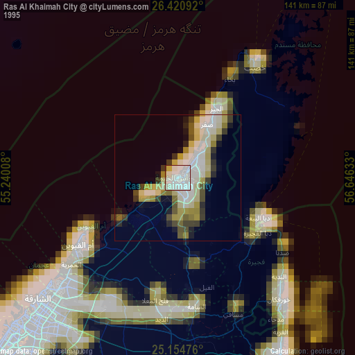
» NASA, Earths city lights 1995
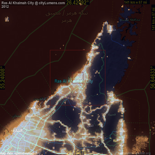
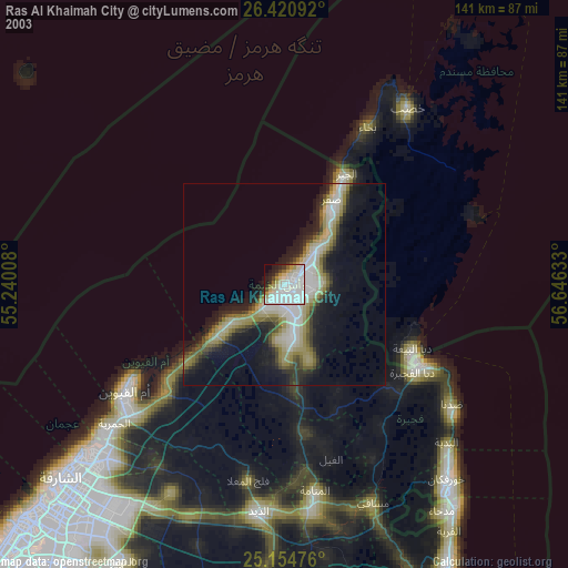
» NASA city lights 2003
» Earth at Night: Flat Maps 2012, 2016