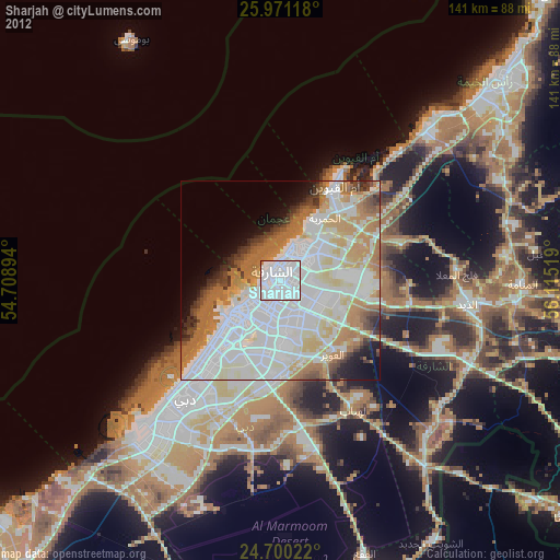
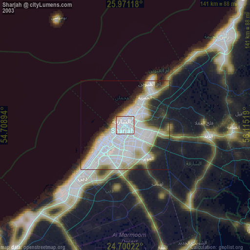
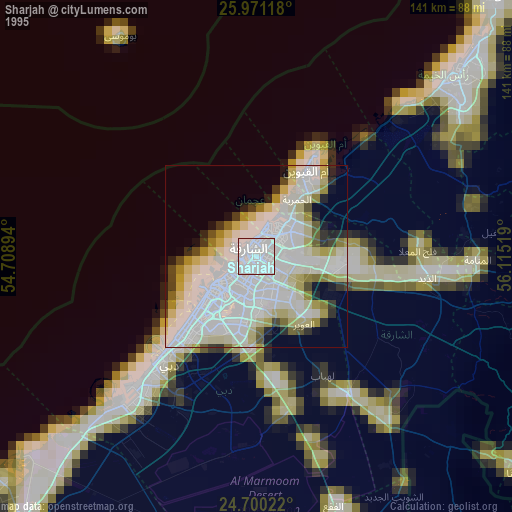
Sharjah night lights from space
Night Light of Sharjah from space (United Arab Emirates) Src. Average luminocity for 10x10km area is 98.623% and for 50x50km: 58.7542%.
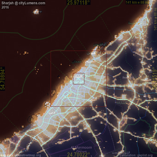
Analysis of Sharjah night lights 2016
Square area 10x10 km:
 85.91%
90-99
10.12%80-89
1.39%70-79
0.2%60-69
1.79%50-59
0.6%40-49
0%30-39
0%20-29
0%10-19
0%0-9
0%Square area 50x50 km:
23.12%90-99
14.82%80-89
5.4%70-79
6.24%60-69
8.43%50-59
4.77%40-49
2.9%30-39
2.83%20-29
3.37%10-19
4.76%0-9
23.36%Clear (daylight) street map image can be seen on geolist.org.
Map coordinates:
25° 58' 16.2" North, 54° 42' 32.2" East
25° 20' 14.5" North, 55° 24' 43.4" East
24° 42' 0.8" North, 56° 6' 54.7" East
Some cities around Sharjah sort by population:
• Dubai
30.7 km =19.1 mi,  199°
199°
• Ajman City
9.8 km =6.1 mi,  43°
43°
• Ras Al Khaimah City
73.3 km =45.5 mi,  46°
46°
• Reef Al Fujairah City
86.7 km =53.9 mi,  104°
104°
• Umm Al Quwain City
29.1 km =18.1 mi,  29°
29°
• Dibba Al-Fujairah
89.9 km =55.9 mi,  71°
71°
• Dibba Al-Hisn
91.9 km =57.1 mi, 70°
• Adh Dhayd
47.5 km =29.5 mi, 96°
292672 (p: 1,324,473)
Sources (retrieved 2019-11-25):
» NASA, Earths city lights 1995
» NASA city lights 2003
» Earth at Night: Flat Maps 2012, 2016