Koysinceq night lights from space
Night Light of Koysinceq (Arbīl) from space (Iraq) Src. Average luminocity for 10x10km area is 34.7821% and for 50x50km: 8.2133%.
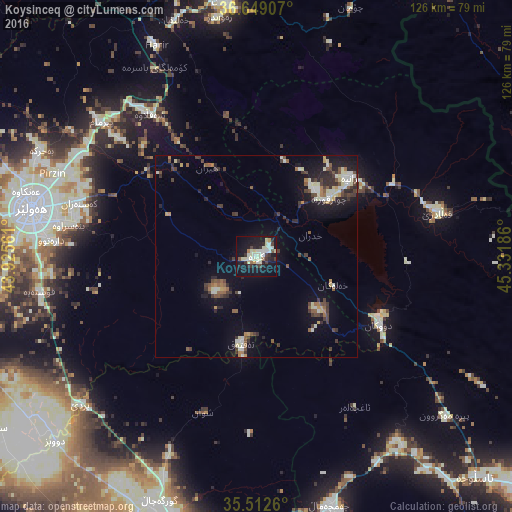
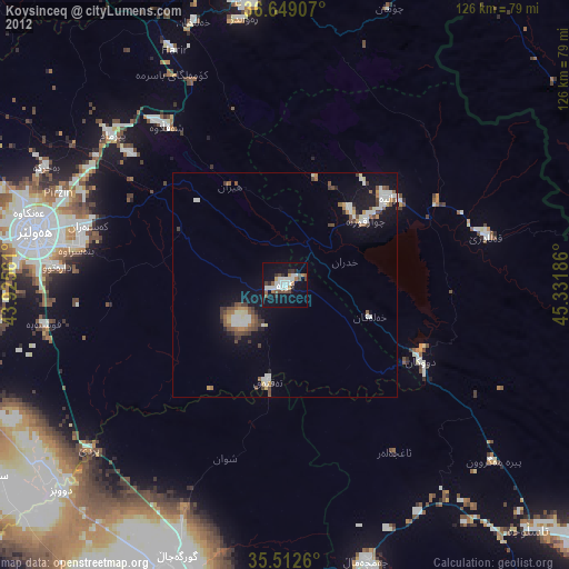
Analysis of Koysinceq night lights 2016
Square area 10x10 km:
 0.55%
0.55%90-99
13.37%80-89
8.42%70-79
1.47%60-69
1.65%50-59
1.65%40-49
2.38%30-39
5.31%20-29
7.88%10-19
41.03%0-9
16.3%Square area 50x50 km:
0.4%90-99
1.82%80-89
1.1%70-79
0.51%60-69
0.69%50-59
1.16%40-49
1.22%30-39
1.81%20-29
1.97%10-19
6.22%0-9
83.08%Clear (daylight) street map image can be seen on geolist.org.
Map coordinates:
36° 38' 56.7" North, 43° 55' 32.2" East
36° 4' 58.4" North, 44° 37' 43.4" East
35° 30' 45.4" North, 45° 19' 54.7" East
Some cities around Koysinceq sort by population:
• Erbil
56.5 km =35.1 mi,  281°
281°
• As Sulaymānīyah
92.6 km =57.5 mi,  128°
128°
• Kirkuk
71.6 km =44.5 mi,  197°
197°
• Soran
63.9 km =39.7 mi,  353°
353°
• Jamjamāl
63.8 km =39.6 mi,  163°
163°
• Piranshahr, IR
82.6 km =51.3 mi,  33°
33°
• ‘Aqrah
100 km =62.1 mi,  318°
318°
• Ṟuwandiz
59.6 km =37 mi, 350°
94220 (p: 44,987)
Sources (retrieved 2019-11-25):
» Earth at Night: Flat Maps 2012, 2016