Erbil night lights from space
Night Light of Erbil (Arbīl) from space (Iraq) Src. Average luminocity for 10x10km area is 98.9038% and for 50x50km: 42.2453%.
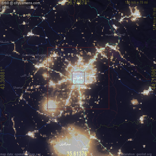
Analysis of Erbil night lights 2016
Square area 10x10 km:
 68.88%
90-99
27.8%80-89
2.62%70-79
0.35%60-69
0.35%50-59
0%40-49
0%30-39
0%20-29
0%10-19
0%0-9
0%Square area 50x50 km:
6.02%90-99
11.21%80-89
5.84%70-79
3.44%60-69
4.15%50-59
6.2%40-49
8.37%30-39
8.86%20-29
11.57%10-19
12.49%0-9
21.86%Clear (daylight) street map image can be seen on geolist.org.
Map coordinates:
36° 44' 55.6" North, 43° 18' 31.7" East
36° 10' 60" North, 44° 0' 42.9" East
35° 36' 49.5" North, 44° 42' 54.2" East
Some cities around Erbil sort by population:
• Al Mawşil al Jadīdah
82.9 km =51.5 mi,  281°
281°
• Mosul
81.8 km =50.8 mi, 281°
• Kirkuk
86.6 km =53.8 mi,  156°
156°
• Soran
70.7 km =43.9 mi,  42°
42°
• Al-Hamdaniya
57.7 km =35.9 mi, 279°
• Koysinceq
56.5 km =35.1 mi,  101°
101°
• ‘Aqrah
65 km =40.4 mi,  350°
350°
• Ṟuwandiz
66.1 km =41.1 mi, 43°
95446 (p: 932,800)
Sources (retrieved 2019-11-25):
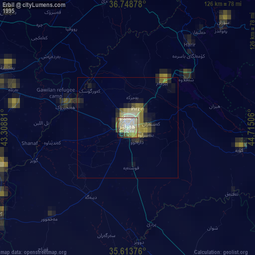
» NASA, Earths city lights 1995
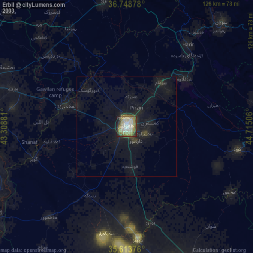
» NASA city lights 2003
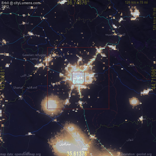
» Earth at Night: Flat Maps 2012, 2016