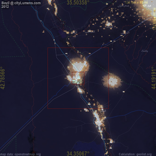
Bayjī night lights from space
Night Light of Bayjī (Salah ad Din) from space (Iraq) Src. Average luminocity for 10x10km area is 8.2033% and for 50x50km: 3.6296%.
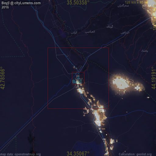
Analysis of Bayjī night lights 2016
Square area 10x10 km:
 0.37%
0.37%90-99
0.92%80-89
0.55%70-79
1.28%60-69
0.55%50-59
0.55%40-49
3.11%30-39
0.92%20-29
3.3%10-19
4.21%0-9
84.25%Square area 50x50 km:
0.1%90-99
0.72%80-89
0.25%70-79
0.26%60-69
0.35%50-59
0.55%40-49
0.88%30-39
0.67%20-29
1.17%10-19
4.06%0-9
91%Clear (daylight) street map image can be seen on geolist.org.
Map coordinates:
35° 30' 12.9" North, 42° 47' 8.4" East
34° 55' 44.9" North, 43° 29' 19.6" East
34° 21' 2.4" North, 44° 11' 30.9" East
Some cities around Bayjī sort by population:
• Kirkuk
101.6 km =63.1 mi,  53°
53°
• Sāmarrā’
89.3 km =55.5 mi,  155°
155°
• Tozkhurmato
104.4 km =64.9 mi,  92°
92°
• Tikrīt
38.9 km =24.2 mi,  153°
153°
• Balad
118.2 km =73.4 mi, 149°
• Ḩadīthah
134.7 km =83.7 mi,  229°
229°
• Kifrī
137 km =85.1 mi,  101°
101°
• Ad Dujayl
138.4 km =86 mi, 150°
97783 (p: 36,454)
Sources (retrieved 2019-11-25):
» Earth at Night: Flat Maps 2012, 2016