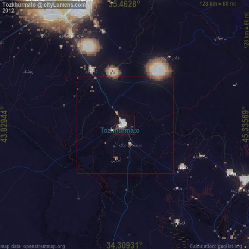
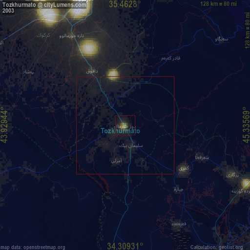
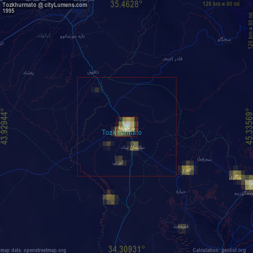
Tozkhurmato night lights from space
Night Light of Tozkhurmato (Salah ad Din) from space (Iraq) Src. Average luminocity for 10x10km area is 46.0238% and for 50x50km: 4.6146%.

Analysis of Tozkhurmato night lights 2016
Square area 10x10 km:
 6.23%
6.23%90-99
17.4%80-89
1.65%70-79
2.75%60-69
6.59%50-59
6.41%40-49
3.85%30-39
9.34%20-29
11.54%10-19
28.57%0-9
5.68%Square area 50x50 km:
0.3%90-99
1.05%80-89
0.3%70-79
0.31%60-69
0.53%50-59
0.47%40-49
0.67%30-39
1.15%20-29
1.03%10-19
4.18%0-9
90%Clear (daylight) street map image can be seen on geolist.org.
Map coordinates:
35° 27' 46.1" North, 43° 55' 46" East
34° 53' 17.1" North, 44° 37' 57.2" East
34° 18' 33.5" North, 45° 20' 8.5" East
Some cities around Tozkhurmato sort by population:
• As Sulaymānīyah
104.6 km =65 mi,  44°
44°
• Kirkuk
68.1 km =42.3 mi,  341°
341°
• Sāmarrā’
103 km =64 mi,  221°
221°
• Jamjamāl
74.1 km =46 mi,  14°
14°
• Al Miqdādīyah
104.9 km =65.2 mi,  164°
164°
• Tikrīt
92.3 km =57.4 mi,  250°
250°
• Bayjī
104.4 km =64.9 mi,  272°
272°
• Kifrī
37.2 km =23.1 mi,  126°
126°
90026 (p: 59,886)
Sources (retrieved 2019-11-25):
» NASA, Earths city lights 1995
» NASA city lights 2003
» Earth at Night: Flat Maps 2012, 2016