Wani night lights from space
Night Light of Wani (Maharashtra) from space (India) Src. Average luminocity for 10x10km area is 33.6429% and for 50x50km: 14.4231%.
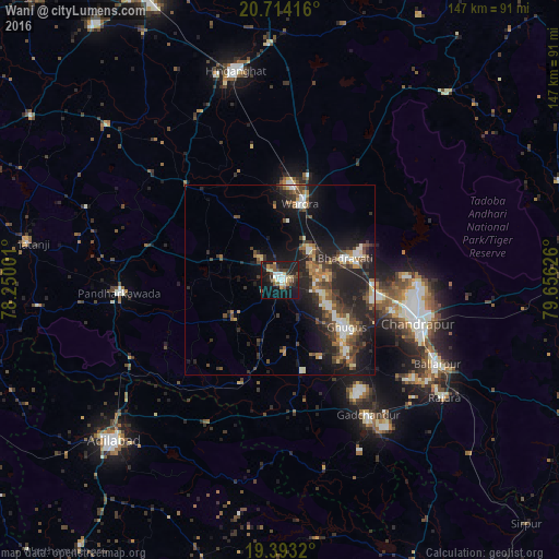
Analysis of Wani night lights 2016
Square area 10x10 km:
 4.56%
4.56%90-99
4.17%80-89
6.94%70-79
1.98%60-69
0.6%50-59
6.75%40-49
4.37%30-39
5.95%20-29
12.3%10-19
40.48%0-9
11.9%Square area 50x50 km:
1.46%90-99
1.91%80-89
1.42%70-79
1.25%60-69
1.78%50-59
2.29%40-49
2.85%30-39
3.52%20-29
6.61%10-19
11.98%0-9
64.94%Clear (daylight) street map image can be seen on geolist.org.
Map coordinates:
20° 42' 51" North, 78° 15' 0" East
20° 3' 18.3" North, 78° 57' 11.3" East
19° 23' 35.5" North, 79° 39' 22.5" East
Some cities around Wani sort by population:
• Chānda
37.6 km =23.4 mi,  107°
107°
• Ballālpur
47.1 km =29.3 mi,  119°
119°
• Warora
20 km =12.4 mi,  15°
15°
• Ghugus
21.1 km =13.1 mi,  128°
128°
• Rājūra
52.8 km =32.8 mi, 125°
• Chāndur
42.3 km =26.3 mi,  147°
147°
• Durgāpur
36.9 km =22.9 mi,  98°
98°
• Rājur
8.8 km =5.5 mi,  314°
314°
1252960 (p: 57,288)
Sources (retrieved 2019-11-25):
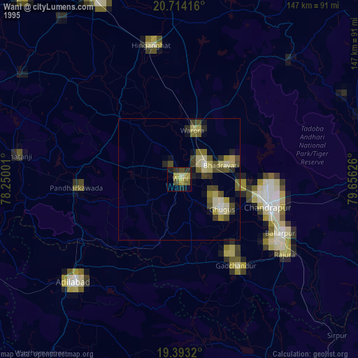
» NASA, Earths city lights 1995
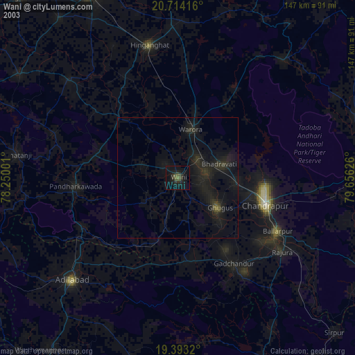
» NASA city lights 2003
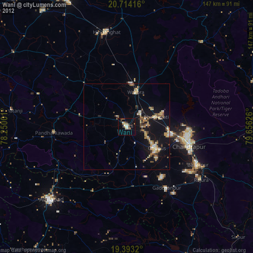
» Earth at Night: Flat Maps 2012, 2016