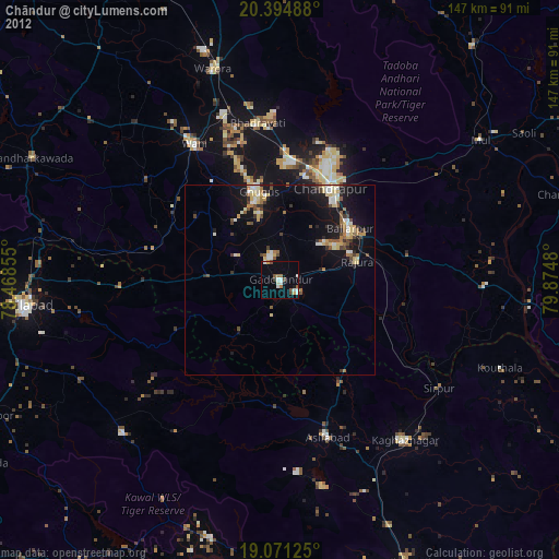
Chāndur night lights from space
Night Light of Chāndur (Maharashtra) from space (India) Src. Average luminocity for 10x10km area is 39.0682% and for 50x50km: 13.3142%.
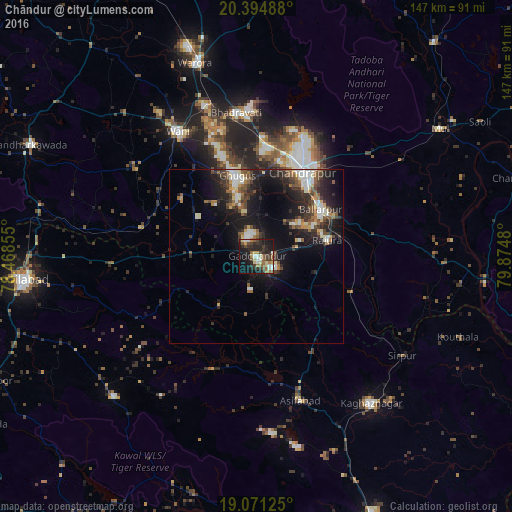
Analysis of Chāndur night lights 2016
Square area 10x10 km:
 3.72%
3.72%90-99
4.96%80-89
5.79%70-79
3.51%60-69
5.99%50-59
7.64%40-49
5.99%30-39
10.33%20-29
17.36%10-19
28.51%0-9
6.2%Square area 50x50 km:
1.45%90-99
2.11%80-89
1.32%70-79
0.92%60-69
1.55%50-59
2.29%40-49
2.18%30-39
3.09%20-29
5.08%10-19
11.52%0-9
68.49%Clear (daylight) street map image can be seen on geolist.org.
Map coordinates:
20° 23' 41.6" North, 78° 28' 6.8" East
19° 44' 4" North, 79° 10' 18" East
19° 4' 16.5" North, 79° 52' 29.3" East
Some cities around Chāndur sort by population:
• Ballālpur
22.1 km =13.7 mi,  55°
55°
• Wani
42.3 km =26.3 mi,  327°
327°
• Ghugus
23.5 km =14.6 mi,  344°
344°
• Rājūra
20.8 km =12.9 mi,  76°
76°
• Asifābād
43.4 km =27 mi,  164°
164°
• Durgāpur
33.1 km =20.6 mi,  24°
24°
• Rājur
51 km =31.7 mi, 325°
• Sirpur
50.9 km =31.6 mi,  123°
123°
1274676 (p: 23,125)
Sources (retrieved 2019-11-25):
» Earth at Night: Flat Maps 2012, 2016