Chānda night lights from space
Night Light of Chānda (Maharashtra) from space (India) Src. Average luminocity for 10x10km area is 76.961% and for 50x50km: 22.2798%.
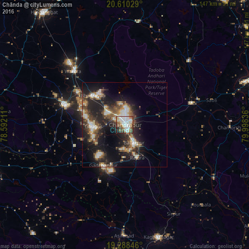

Analysis of Chānda night lights 2016
Square area 10x10 km:
 26.19%
90-99
27.27%80-89
4.76%70-79
3.03%60-69
8.44%50-59
10.82%40-49
7.36%30-39
5.63%20-29
5.19%10-19
1.3%0-9
0%Square area 50x50 km:
3.18%90-99
3.81%80-89
2.02%70-79
1.98%60-69
2.51%50-59
3.62%40-49
4.14%30-39
4.84%20-29
8.76%10-19
15.43%0-9
49.72%Clear (daylight) street map image can be seen on geolist.org.
Map coordinates:
20° 36' 37" North, 78° 35' 31.6" East
19° 57' 2.7" North, 79° 17' 42.8" East
19° 17' 18.5" North, 79° 59' 54.1" East
Some cities around Chānda sort by population:
• Ballālpur
12.7 km =7.9 mi,  155°
155°
• Wani
37.6 km =23.4 mi,  287°
287°
• Warora
43.5 km =27 mi,  315°
315°
• Ghugus
19.2 km =11.9 mi,  265°
265°
• Rājūra
20.4 km =12.7 mi, 159°
• Mūl
42.2 km =26.2 mi,  71°
71°
• Durgāpur
6.1 km =3.8 mi,  7°
7°
• Rājur
45.6 km =28.3 mi, 292°
1274693 (p: 328,351)
Sources (retrieved 2019-11-25):
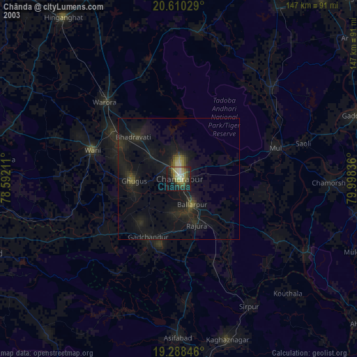
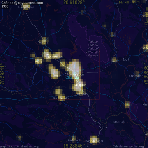
» NASA, Earths city lights 1995
» NASA city lights 2003
» Earth at Night: Flat Maps 2012, 2016