Warora night lights from space
Night Light of Warora (Maharashtra) from space (India) Src. Average luminocity for 10x10km area is 30.8571% and for 50x50km: 10.5048%.
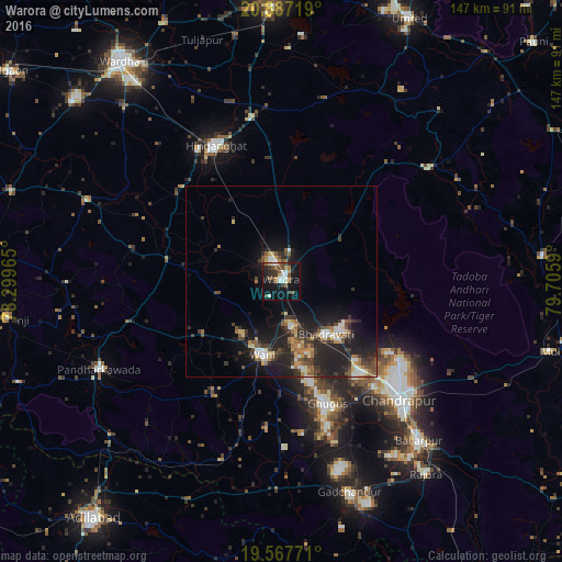
Analysis of Warora night lights 2016
Square area 10x10 km:
 5.16%
5.16%90-99
5.16%80-89
0.79%70-79
0.79%60-69
5.75%50-59
6.75%40-49
4.76%30-39
6.15%20-29
7.54%10-19
32.34%0-9
24.8%Square area 50x50 km:
1.08%90-99
1.21%80-89
1.15%70-79
0.96%60-69
1.32%50-59
1.76%40-49
1.76%30-39
2.38%20-29
4.63%10-19
9.51%0-9
74.25%Clear (daylight) street map image can be seen on geolist.org.
Map coordinates:
20° 53' 13.9" North, 78° 17' 58.7" East
20° 13' 43.9" North, 79° 0' 10" East
19° 34' 3.8" North, 79° 42' 21.2" East
Some cities around Warora sort by population:
• Chānda
43.5 km =27 mi,  135°
135°
• Hinganghāt
39.4 km =24.5 mi,  334°
334°
• Ballālpur
55.6 km =34.5 mi, 139°
• Wani
20 km =12.4 mi,  195°
195°
• Ghugus
34.3 km =21.3 mi,  160°
160°
• Durgāpur
40 km =24.9 mi,  128°
128°
• Sonegaon
55 km =34.2 mi,  323°
323°
• Rājur
17.4 km =10.8 mi,  221°
221°
1252925 (p: 41,523)
Sources (retrieved 2019-11-25):
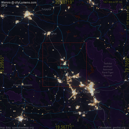
» Earth at Night: Flat Maps 2012, 2016