Sultānpur night lights from space
Night Light of Sultānpur (Madhya Pradesh) from space (India) Src. Average luminocity for 10x10km area is 10.1742% and for 50x50km: 4.8518%.
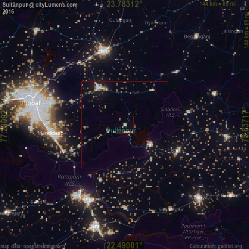
Analysis of Sultānpur night lights 2016
Square area 10x10 km:
 0.57%
0.57%90-99
0.95%80-89
1.14%70-79
2.27%60-69
2.46%50-59
1.7%40-49
0%30-39
1.89%20-29
2.08%10-19
1.7%0-9
85.23%Square area 50x50 km:
0.31%90-99
0.38%80-89
0.41%70-79
0.53%60-69
0.91%50-59
0.88%40-49
0.64%30-39
1.06%20-29
1.38%10-19
2.5%0-9
91%Clear (daylight) street map image can be seen on geolist.org.
Map coordinates:
23° 46' 59.2" North, 77° 13' 51.3" East
23° 8' 17.2" North, 77° 56' 2.5" East
22° 29' 24" North, 78° 38' 13.8" East
Some cities around Sultānpur sort by population:
• Bhopal
55.8 km =34.7 mi,  283°
283°
• Vidisha
44.9 km =27.9 mi,  343°
343°
• Hoshangābād
48.3 km =30 mi,  205°
205°
• Raisen
26.5 km =16.5 mi,  323°
323°
• Mandideep
41.5 km =25.8 mi,  261°
261°
• Sohāgpur
55.5 km =34.5 mi,  151°
151°
• Bābai
48.4 km =30.1 mi,  179°
179°
• Sānchi
43.6 km =27.1 mi,  332°
332°
1255493 (p: 9,419)
Sources (retrieved 2019-11-25):
» Earth at Night: Flat Maps 2012, 2016