Hoshangābād night lights from space
Night Light of Hoshangābād (Madhya Pradesh) from space (India) Src. Average luminocity for 10x10km area is 50.9583% and for 50x50km: 11.8357%.
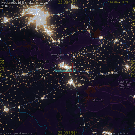
Analysis of Hoshangābād night lights 2016
Square area 10x10 km:
 10.32%
90-99
11.51%80-89
4.96%70-79
4.17%60-69
6.94%50-59
7.54%40-49
7.34%30-39
8.93%20-29
18.06%10-19
19.64%0-9
0.6%Square area 50x50 km:
1.16%90-99
1.8%80-89
1.05%70-79
0.82%60-69
1.61%50-59
1.98%40-49
1.8%30-39
2%20-29
3.79%10-19
9.03%0-9
74.97%Clear (daylight) street map image can be seen on geolist.org.
Map coordinates:
23° 23' 39.7" North, 77° 1' 27.3" East
22° 44' 50.9" North, 77° 43' 38.5" East
22° 5' 51" North, 78° 25' 49.8" East
Some cities around Hoshangābād sort by population:
• Itārsi
15.2 km =9.4 mi,  166°
166°
• Mandideep
42.1 km =26.2 mi,  331°
331°
• Seoni Mālwa
42.5 km =26.4 mi,  219°
219°
• Sohāgpur
48.3 km =30 mi,  96°
96°
• Nasrullāhganj
47.4 km =29.5 mi,  261°
261°
• Bābai
21.9 km =13.6 mi, 103°
• Rehti
30.1 km =18.7 mi,  267°
267°
• Sultānpur
48.3 km =30 mi,  25°
25°
1269939 (p: 109,358)
Sources (retrieved 2019-11-25):
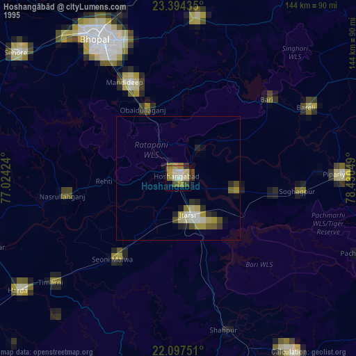
» NASA, Earths city lights 1995
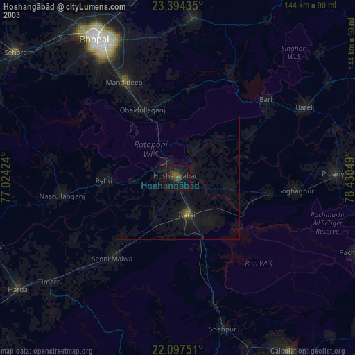
» NASA city lights 2003
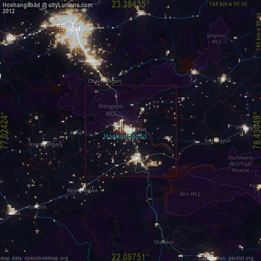
» Earth at Night: Flat Maps 2012, 2016