Vidisha night lights from space
Night Light of Vidisha (Madhya Pradesh) from space (India) Src. Average luminocity for 10x10km area is 51.3532% and for 50x50km: 7.9458%.
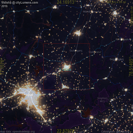
Analysis of Vidisha night lights 2016
Square area 10x10 km:
 8.93%
8.93%90-99
12.5%80-89
3.97%70-79
4.56%60-69
6.15%50-59
9.33%40-49
9.52%30-39
10.52%20-29
14.68%10-19
19.44%0-9
0.4%Square area 50x50 km:
0.65%90-99
0.87%80-89
0.56%70-79
0.78%60-69
1.09%50-59
1.54%40-49
1.6%30-39
1.5%20-29
2.16%10-19
6.72%0-9
82.54%Clear (daylight) street map image can be seen on geolist.org.
Map coordinates:
24° 10' 8.9" North, 77° 6' 28.1" East
23° 31' 33.7" North, 77° 48' 39.3" East
22° 52' 47.2" North, 78° 30' 50.6" East
Some cities around Vidisha sort by population:
• Bhopal
51.4 km =31.9 mi,  234°
234°
• Bāsoda
38.4 km =23.9 mi,  19°
19°
• Raisen
22 km =13.7 mi,  187°
187°
• Mandideep
57 km =35.4 mi,  209°
209°
• Begamganj
54.6 km =33.9 mi,  81°
81°
• Berasia
40.2 km =25 mi,  286°
286°
• Sultānpur
44.9 km =27.9 mi,  163°
163°
• Sānchi
8.7 km =5.4 mi,  239°
239°
1253200 (p: 140,045)
Sources (retrieved 2019-11-25):
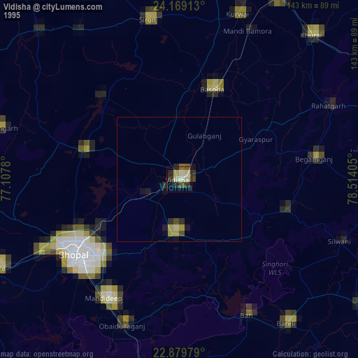
» NASA, Earths city lights 1995
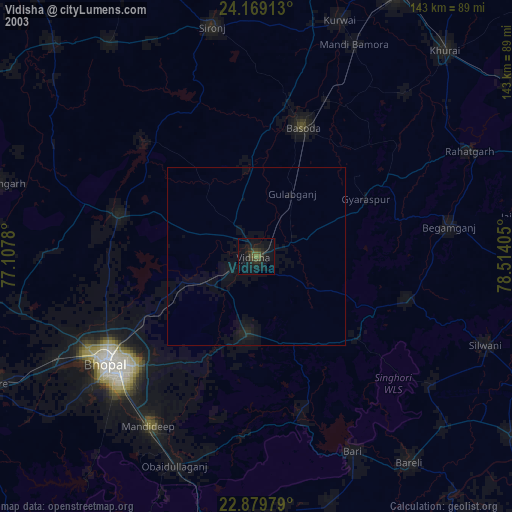
» NASA city lights 2003
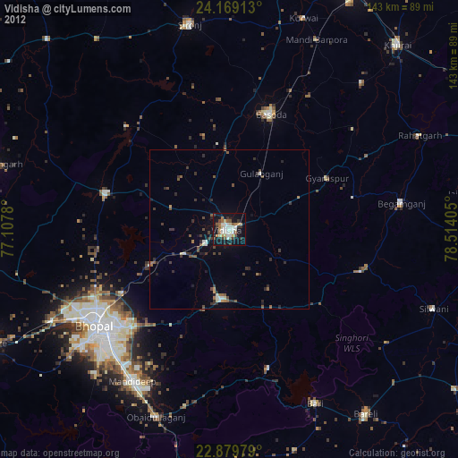
» Earth at Night: Flat Maps 2012, 2016