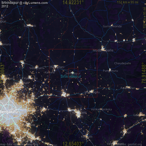
Srīnivāspur night lights from space
Night Light of Srīnivāspur (Karnataka) from space (India) Src. Average luminocity for 10x10km area is 17.469% and for 50x50km: 11.8535%.
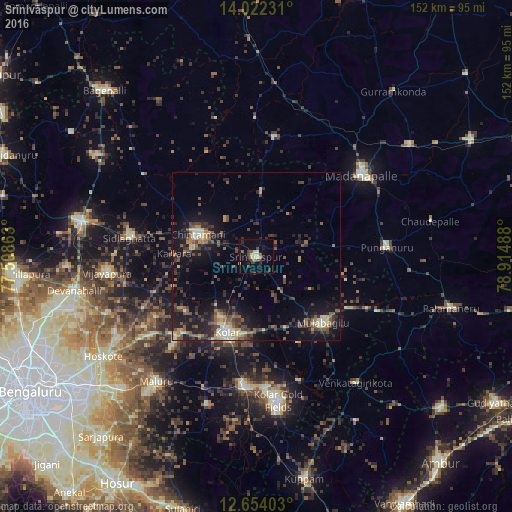
Analysis of Srīnivāspur night lights 2016
Square area 10x10 km:
 0%
0%90-99
2.89%80-89
2.89%70-79
1.45%60-69
1.86%50-59
1.45%40-49
3.72%30-39
3.51%20-29
4.75%10-19
9.3%0-9
68.18%Square area 50x50 km:
0.35%90-99
1.3%80-89
1.58%70-79
1%60-69
1.39%50-59
2.27%40-49
2.85%30-39
2.82%20-29
4.27%10-19
10.24%0-9
71.93%Clear (daylight) street map image can be seen on geolist.org.
Map coordinates:
14° 1' 20.3" North, 77° 30' 31.1" East
13° 20' 20.9" North, 78° 12' 42.3" East
12° 39' 14.5" North, 78° 54' 53.6" East
Some cities around Srīnivāspur sort by population:
• Robertsonpet
43.1 km =26.8 mi,  170°
170°
• Kolār
24.1 km =15 mi,  201°
201°
• Madanapalle
39.3 km =24.4 mi,  53°
53°
• Chintāmani
18.6 km =11.6 mi,  291°
291°
• Sidlaghatta
38 km =23.6 mi,  278°
278°
• Punganūru
39.1 km =24.3 mi,  85°
85°
• Mulbāgal
27.7 km =17.2 mi,  134°
134°
• Bangarapet
38.9 km =24.2 mi,  185°
185°
1255631 (p: 25,760)
Sources (retrieved 2019-11-25):
» Earth at Night: Flat Maps 2012, 2016