Madanapalle night lights from space
Night Light of Madanapalle (Andhra Pradesh) from space (India) Src. Average luminocity for 10x10km area is 29.2624% and for 50x50km: 2.8392%.
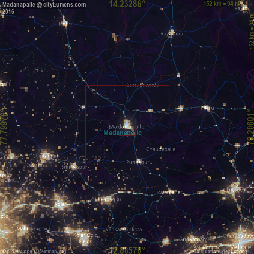
Analysis of Madanapalle night lights 2016
Square area 10x10 km:
 2.48%
2.48%90-99
6.4%80-89
6.61%70-79
1.86%60-69
2.89%50-59
2.27%40-49
5.37%30-39
3.51%20-29
4.96%10-19
27.89%0-9
35.74%Square area 50x50 km:
0.1%90-99
0.44%80-89
0.36%70-79
0.25%60-69
0.31%50-59
0.38%40-49
0.6%30-39
0.68%20-29
0.74%10-19
1.74%0-9
94.39%Clear (daylight) street map image can be seen on geolist.org.
Map coordinates:
14° 13' 58.3" North, 77° 47' 59.1" East
13° 33' 1.1" North, 78° 30' 10.4" East
12° 51' 56.8" North, 79° 12' 21.6" East
Some cities around Madanapalle sort by population:
• Kolār
61.1 km =38 mi,  221°
221°
• Rāyachoti
62.4 km =38.8 mi,  25°
25°
• Chintāmani
51.5 km =32 mi,  251°
251°
• Punganūru
21.7 km =13.5 mi,  159°
159°
• Mulbāgal
44.6 km =27.7 mi,  195°
195°
• Palmaner
47.1 km =29.3 mi,  145°
145°
• Srīnivāspur
39.3 km =24.4 mi,  233°
233°
• Pākāla
67.1 km =41.7 mi,  99°
99°
1264621 (p: 108,593)
Sources (retrieved 2019-11-25):
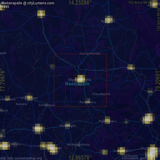
» NASA, Earths city lights 1995
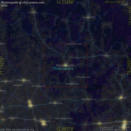
» NASA city lights 2003
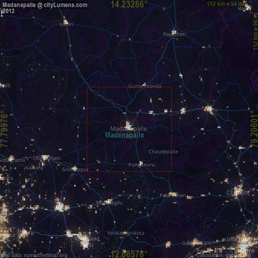
» Earth at Night: Flat Maps 2012, 2016