Sidlaghatta night lights from space
Night Light of Sidlaghatta (Karnataka) from space (India) Src. Average luminocity for 10x10km area is 27.8306% and for 50x50km: 21.1172%.
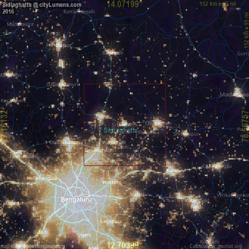
Analysis of Sidlaghatta night lights 2016
Square area 10x10 km:
 0.41%
0.41%90-99
4.34%80-89
3.72%70-79
2.48%60-69
2.07%50-59
5.37%40-49
6.2%30-39
8.26%20-29
8.06%10-19
40.29%0-9
18.8%Square area 50x50 km:
0.72%90-99
3.08%80-89
3.15%70-79
2.13%60-69
2.41%50-59
4.36%40-49
5.36%30-39
5.49%20-29
6.74%10-19
16.23%0-9
50.35%Clear (daylight) street map image can be seen on geolist.org.
Map coordinates:
14° 4' 19.2" North, 77° 9' 40.8" East
13° 23' 20.3" North, 77° 51' 52" East
12° 42' 14.4" North, 78° 34' 3.3" East
Some cities around Sidlaghatta sort by population:
• Dod Ballāpur
36.9 km =22.9 mi,  253°
253°
• Chintāmani
20.3 km =12.6 mi,  86°
86°
• Chik Ballāpur
15.6 km =9.7 mi,  289°
289°
• Hoskote
36.1 km =22.4 mi,  191°
191°
• Vadigenhalli
12.2 km =7.6 mi,  213°
213°
• Srīnivāspur
38 km =23.6 mi,  98°
98°
• Devanhalli
22.9 km =14.2 mi,  226°
226°
• Gudibanda
35.8 km =22.2 mi,  331°
331°
1256363 (p: 49,114)
Sources (retrieved 2019-11-25):
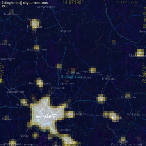
» NASA, Earths city lights 1995
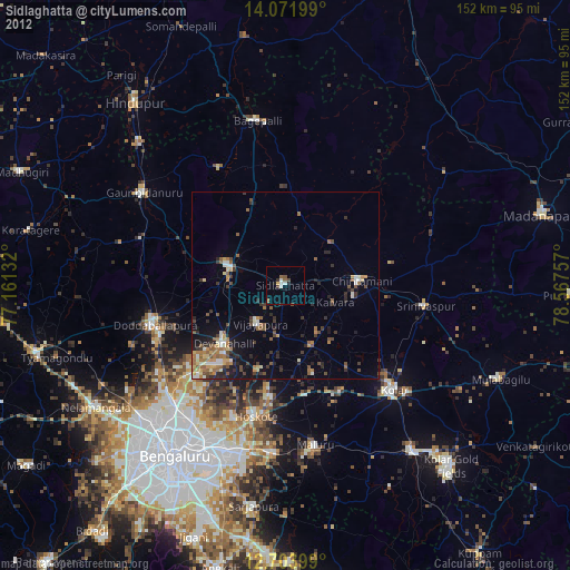
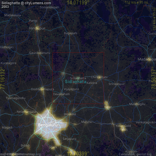
» NASA city lights 2003
» Earth at Night: Flat Maps 2012, 2016