Chintāmani night lights from space
Night Light of Chintāmani (Karnataka) from space (India) Src. Average luminocity for 10x10km area is 40.3264% and for 50x50km: 10.8247%.
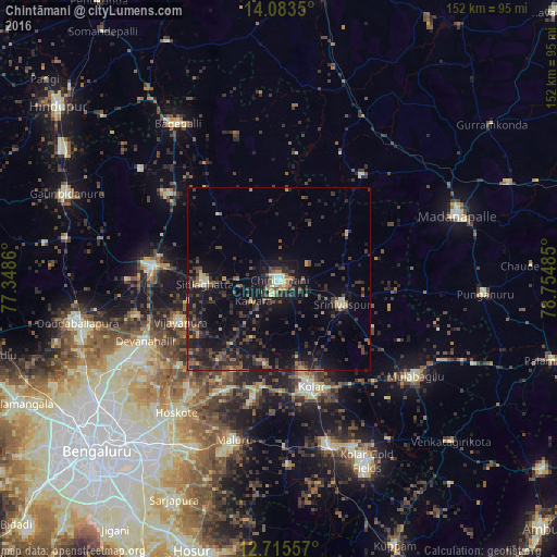
Analysis of Chintāmani night lights 2016
Square area 10x10 km:
 3.31%
3.31%90-99
5.99%80-89
6.4%70-79
5.58%60-69
6.82%50-59
6.82%40-49
7.23%30-39
8.06%20-29
9.71%10-19
33.47%0-9
6.61%Square area 50x50 km:
0.15%90-99
0.68%80-89
0.79%70-79
0.86%60-69
1.09%50-59
2.02%40-49
3.16%30-39
3.86%20-29
4.7%10-19
11.41%0-9
71.28%Clear (daylight) street map image can be seen on geolist.org.
Map coordinates:
14° 5' 0.6" North, 77° 20' 55" East
13° 24' 1.8" North, 78° 3' 6.2" East
12° 42' 56.1" North, 78° 45' 17.5" East
Some cities around Chintāmani sort by population:
• Kolār
30.4 km =18.9 mi,  163°
163°
• Chik Ballāpur
35.2 km =21.9 mi,  276°
276°
• Sidlaghatta
20.3 km =12.6 mi,  266°
266°
• Mulbāgal
45.4 km =28.2 mi,  125°
125°
• Hoskote
45.8 km =28.5 mi,  216°
216°
• Vadigenhalli
29.4 km =18.3 mi,  246°
246°
• Srīnivāspur
18.6 km =11.6 mi,  111°
111°
• Devanhalli
40.6 km =25.2 mi, 245°
1274129 (p: 71,798)
Sources (retrieved 2019-11-25):
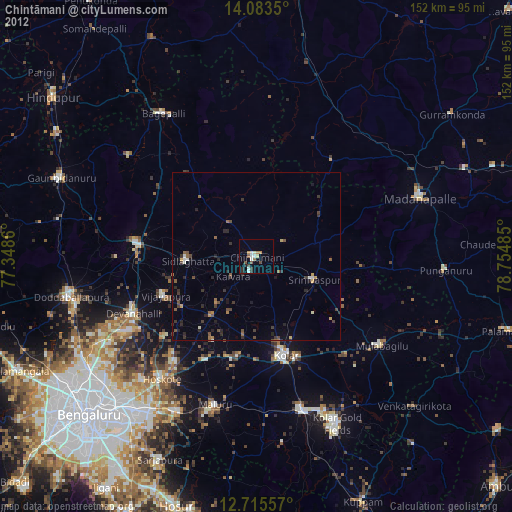
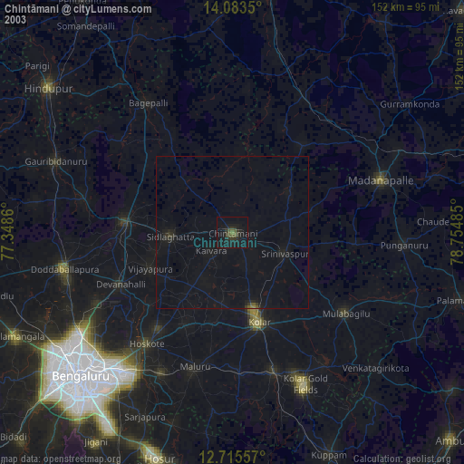
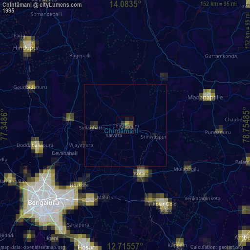
» NASA, Earths city lights 1995
» NASA city lights 2003
» Earth at Night: Flat Maps 2012, 2016