Sirsa night lights from space
Night Light of Sirsa (Haryana) from space (India) Src. Average luminocity for 10x10km area is 59.0227% and for 50x50km: 6.4212%.
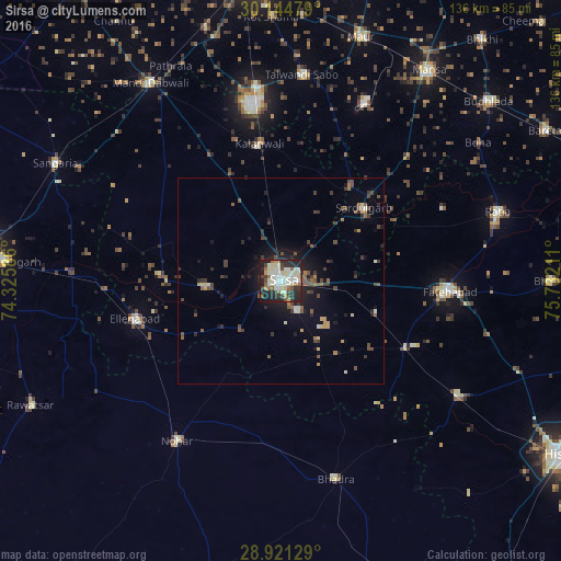
Analysis of Sirsa night lights 2016
Square area 10x10 km:
 8.71%
8.71%90-99
21.21%80-89
12.31%70-79
2.08%60-69
5.3%50-59
5.49%40-49
5.49%30-39
7.2%20-29
21.78%10-19
10.04%0-9
0.38%Square area 50x50 km:
0.44%90-99
1.09%80-89
0.72%70-79
0.39%60-69
0.66%50-59
1.17%40-49
1.26%30-39
1.43%20-29
1.91%10-19
4.06%0-9
86.85%Clear (daylight) street map image can be seen on geolist.org.
Map coordinates:
30° 8' 41.2" North, 74° 19' 33.1" East
29° 32' 5.6" North, 75° 1' 44.3" East
28° 55' 16.6" North, 75° 43' 55.6" East
Some cities around Sirsa sort by population:
• Fatehābād
41.3 km =25.7 mi,  93°
93°
• Dabwāli
53.9 km =33.5 mi,  328°
328°
• Nohar
46.5 km =28.9 mi,  212°
212°
• Ellenabad
36.7 km =22.8 mi,  255°
255°
• Bhādra
50 km =31.1 mi,  163°
163°
• Kālānwāli
33.9 km =21.1 mi,  350°
350°
• Rānia
18.6 km =11.6 mi,  266°
266°
• Sardulgarh
26.6 km =16.5 mi,  48°
48°
1256052 (p: 181,639)
Sources (retrieved 2019-11-25):
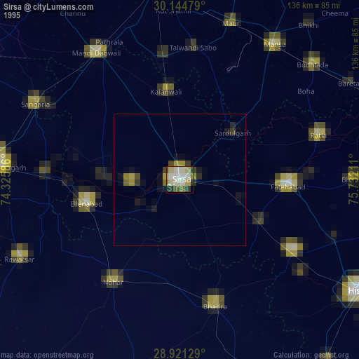
» NASA, Earths city lights 1995
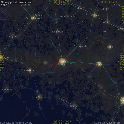
» NASA city lights 2003
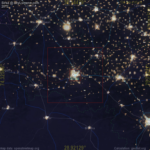
» Earth at Night: Flat Maps 2012, 2016