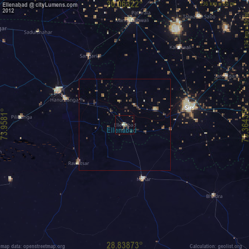
Ellenabad night lights from space
Night Light of Ellenabad (Haryana) from space (India) Src. Average luminocity for 10x10km area is 15.4356% and for 50x50km: 2.1883%.
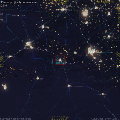
Analysis of Ellenabad night lights 2016
Square area 10x10 km:
 1.52%
1.52%90-99
3.03%80-89
0.76%70-79
0.95%60-69
3.22%50-59
1.14%40-49
3.79%30-39
3.03%20-29
1.7%10-19
2.27%0-9
78.6%Square area 50x50 km:
0.07%90-99
0.14%80-89
0.23%70-79
0.1%60-69
0.33%50-59
0.31%40-49
0.75%30-39
0.72%20-29
0.55%10-19
0.63%0-9
96.15%Clear (daylight) street map image can be seen on geolist.org.
Map coordinates:
30° 3' 47.6" North, 73° 57' 29.2" East
29° 27' 10.2" North, 74° 39' 40.4" East
28° 50' 19.4" North, 75° 21' 51.7" East
Some cities around Ellenabad sort by population:
• Sirsa
36.7 km =22.8 mi,  75°
75°
• Hanumāngarh
35.2 km =21.9 mi,  294°
294°
• Nohar
31.8 km =19.8 mi,  160°
160°
• Sangariā
42.8 km =26.6 mi,  333°
333°
• Pilibangan
54.2 km =33.7 mi,  269°
269°
• Rāwatsār
32.4 km =20.1 mi,  230°
230°
• Kālānwāli
52.1 km =32.4 mi,  35°
35°
• Rānia
18.8 km =11.7 mi,  64°
64°
1272061 (p: 37,680)
Sources (retrieved 2019-11-25):
» Earth at Night: Flat Maps 2012, 2016