Sīrkāzhi night lights from space
Night Light of Sīrkāzhi (Tamil Nadu) from space (India) Src. Average luminocity for 10x10km area is 17.0844% and for 50x50km: 7.6234%.
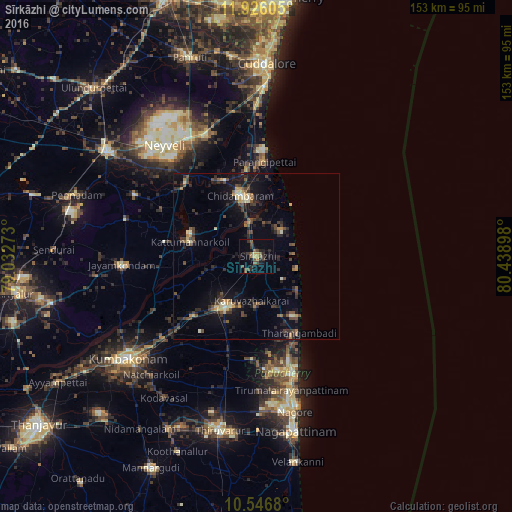
Analysis of Sīrkāzhi night lights 2016
Square area 10x10 km:
 0%
0%90-99
0%80-89
0.43%70-79
3.9%60-69
1.08%50-59
5.63%40-49
5.84%30-39
4.33%20-29
6.49%10-19
7.14%0-9
65.15%Square area 50x50 km:
0.08%90-99
0.67%80-89
0.67%70-79
0.98%60-69
0.49%50-59
1.27%40-49
2.02%30-39
1.86%20-29
3.01%10-19
6.13%0-9
82.8%Clear (daylight) street map image can be seen on geolist.org.
Map coordinates:
11° 55' 33.8" North, 79° 1' 57.8" East
11° 14' 14.1" North, 79° 44' 9.1" East
10° 32' 48.5" North, 80° 26' 20.3" East
Some cities around Sīrkāzhi sort by population:
• Mayiladuthurai
17.3 km =10.7 mi,  210°
210°
• Kāraikāl
37.2 km =23.1 mi,  163°
163°
• Chidambaram
18.7 km =11.6 mi,  344°
344°
• Tharangambadi
26.6 km =16.5 mi,  151°
151°
• Kīl Bhuvanagiri
24.7 km =15.3 mi, 337°
• Tirumullaivāsal
11 km =6.8 mi,  88°
88°
• Aduthurai
37.2 km =23.1 mi,  228°
228°
• Annāmalainagar
18.1 km =11.2 mi,  359°
359°
1256075 (p: 33,100)
Sources (retrieved 2019-11-25):
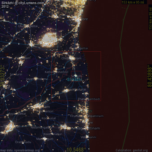
» Earth at Night: Flat Maps 2012, 2016