Mayiladuthurai night lights from space
Night Light of Mayiladuthurai (Tamil Nadu) from space (India) Src. Average luminocity for 10x10km area is 29.7857% and for 50x50km: 9.8092%.
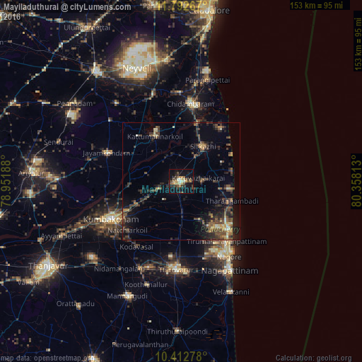
Analysis of Mayiladuthurai night lights 2016
Square area 10x10 km:
 0.43%
0.43%90-99
4.11%80-89
4.98%70-79
7.79%60-69
0.43%50-59
4.98%40-49
5.63%30-39
7.36%20-29
4.98%10-19
33.98%0-9
25.32%Square area 50x50 km:
0.08%90-99
0.78%80-89
0.81%70-79
1.51%60-69
0.64%50-59
1.95%40-49
3.2%30-39
2.43%20-29
4.03%10-19
6.98%0-9
77.6%Clear (daylight) street map image can be seen on geolist.org.
Map coordinates:
11° 47' 33.6" North, 78° 57' 6.8" East
11° 6' 12.7" North, 79° 39' 18" East
10° 24' 46" North, 80° 21' 29.3" East
Some cities around Mayiladuthurai sort by population:
• Kumbakonam
32.8 km =20.4 mi,  241°
241°
• Kāraikāl
28.5 km =17.7 mi,  136°
136°
• Sīrkāzhi
17.3 km =10.7 mi,  30°
30°
• Tharangambadi
23.3 km =14.5 mi,  111°
111°
• Thiruvidaimaruthur
25 km =15.5 mi, 242°
• Tirumullaivāsal
25 km =15.5 mi,  52°
52°
• Aduthurai
21.4 km =13.3 mi, 242°
• Nannilam
25.4 km =15.8 mi,  190°
190°
1263247 (p: 86,660)
Sources (retrieved 2019-11-25):
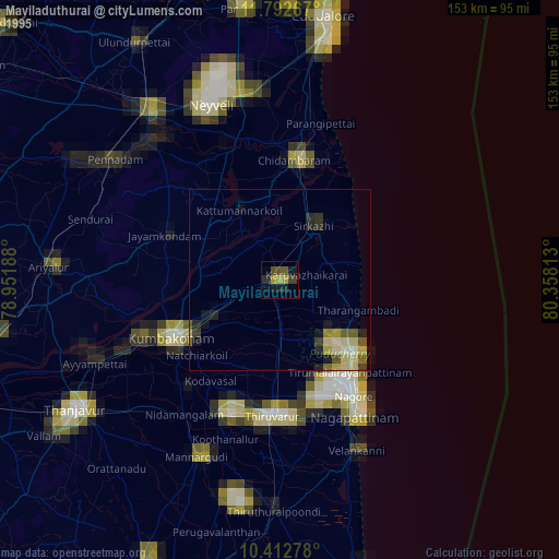
» NASA, Earths city lights 1995
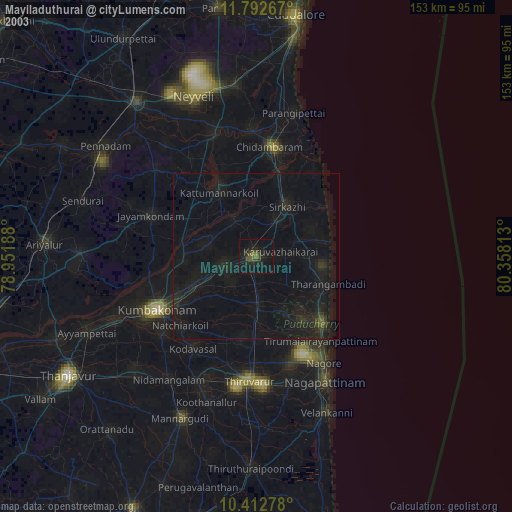
» NASA city lights 2003
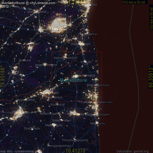
» Earth at Night: Flat Maps 2012, 2016