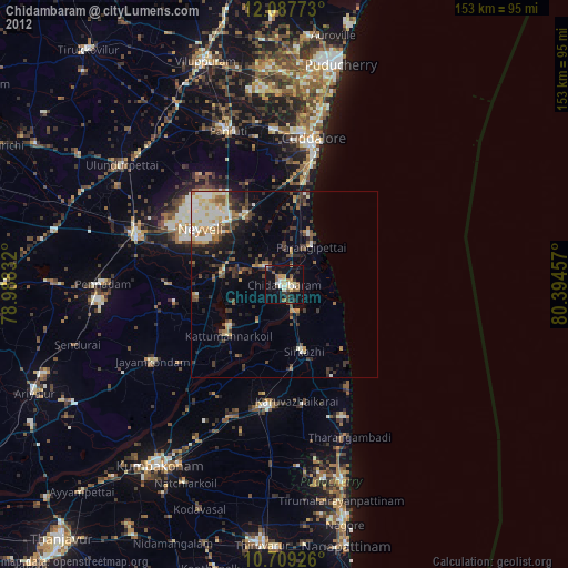
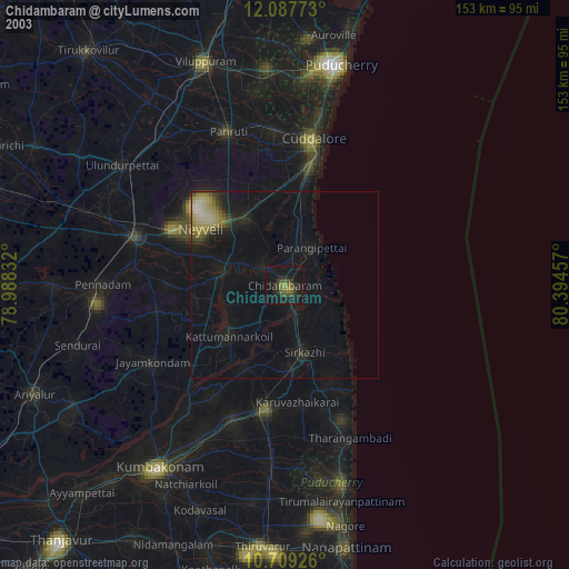
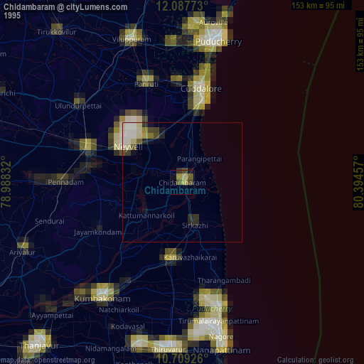
Chidambaram night lights from space
Night Light of Chidambaram (Tamil Nadu) from space (India) Src. Average luminocity for 10x10km area is 32.5238% and for 50x50km: 13.4622%.
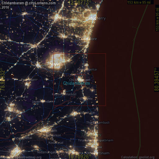
Analysis of Chidambaram night lights 2016
Square area 10x10 km:
 1.3%
1.3%90-99
6.93%80-89
5.63%70-79
3.9%60-69
2.16%50-59
4.76%40-49
5.63%30-39
6.06%20-29
7.36%10-19
44.37%0-9
11.9%Square area 50x50 km:
0.82%90-99
2.62%80-89
2.08%70-79
1.71%60-69
1.1%50-59
2.08%40-49
2.41%30-39
2.44%20-29
3.92%10-19
7.26%0-9
73.57%Clear (daylight) street map image can be seen on geolist.org.
Map coordinates:
12° 5' 15.8" North, 78° 59' 18" East
11° 23' 57.6" North, 79° 41' 29.2" East
10° 42' 33.3" North, 80° 23' 40.5" East
Some cities around Chidambaram sort by population:
• Mayiladuthurai
33.1 km =20.6 mi,  186°
186°
• Sīrkāzhi
18.7 km =11.6 mi,  164°
164°
• Kurinjippādi
20.1 km =12.5 mi,  326°
326°
• Kīl Bhuvanagiri
6.7 km =4.2 mi,  314°
314°
• Tirumullaivāsal
23.8 km =14.8 mi,  138°
138°
• Srīmushnam
31.3 km =19.4 mi,  270°
270°
• Annāmalainagar
4.6 km =2.9 mi,  89°
89°
• Ālappākkam
22.4 km =13.9 mi,  7°
7°
1274256 (p: 58,650)
Sources (retrieved 2019-11-25):
» NASA, Earths city lights 1995
» NASA city lights 2003
» Earth at Night: Flat Maps 2012, 2016