Annāmalainagar night lights from space
Night Light of Annāmalainagar (Tamil Nadu) from space (India) Src. Average luminocity for 10x10km area is 25.7771% and for 50x50km: 10.5997%.
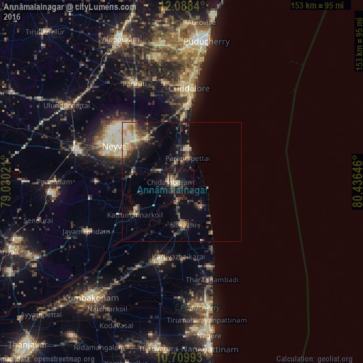
Analysis of Annāmalainagar night lights 2016
Square area 10x10 km:
 1.3%
1.3%90-99
4.76%80-89
4.11%70-79
2.81%60-69
2.16%50-59
3.9%40-49
3.46%30-39
5.19%20-29
8.23%10-19
29.44%0-9
34.63%Square area 50x50 km:
0.29%90-99
1.33%80-89
1.44%70-79
1.55%60-69
1.02%50-59
2.05%40-49
2.18%30-39
2.21%20-29
3.5%10-19
6.97%0-9
77.47%Clear (daylight) street map image can be seen on geolist.org.
Map coordinates:
12° 5' 18.2" North, 79° 1' 48.8" East
11° 24' 0" North, 79° 43' 60" East
10° 42' 35.7" North, 80° 26' 11.3" East
Some cities around Annāmalainagar sort by population:
• Mayiladuthurai
34.1 km =21.2 mi,  194°
194°
• Chidambaram
4.6 km =2.9 mi,  269°
269°
• Sīrkāzhi
18.1 km =11.2 mi,  179°
179°
• Kurinjippādi
22.8 km =14.2 mi,  317°
317°
• Kīl Bhuvanagiri
10.5 km =6.5 mi,  296°
296°
• Tirumullaivāsal
21.1 km =13.1 mi,  147°
147°
• Srīmushnam
35.9 km =22.3 mi, 270°
• Ālappākkam
22.2 km =13.8 mi,  355°
355°
1278546 (p: 8,827)
Sources (retrieved 2019-11-25):
» Earth at Night: Flat Maps 2012, 2016