Sinor night lights from space
Night Light of Sinor (Gujarat) from space (India) Src. Average luminocity for 10x10km area is 3.1984% and for 50x50km: 7.8952%.
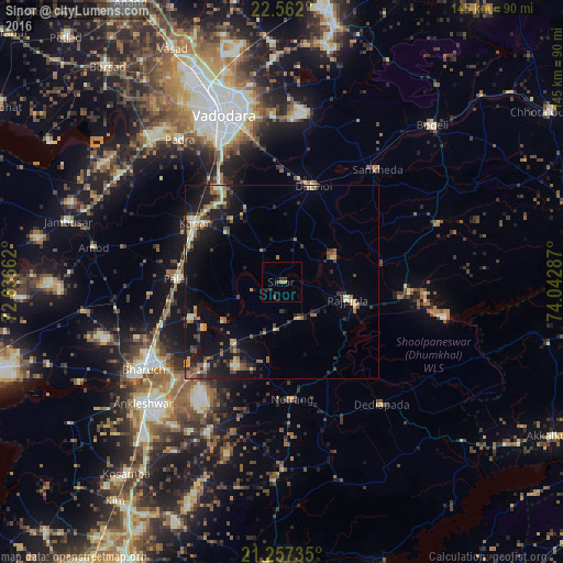
Analysis of Sinor night lights 2016
Square area 10x10 km:
 0%
0%90-99
0%80-89
0%70-79
0.79%60-69
0.6%50-59
0.2%40-49
0%30-39
2.38%20-29
2.58%10-19
0.6%0-9
92.86%Square area 50x50 km:
0.09%90-99
1.09%80-89
1.06%70-79
0.94%60-69
1.24%50-59
1.33%40-49
1.15%30-39
1.59%20-29
2.45%10-19
7.61%0-9
81.46%Clear (daylight) street map image can be seen on geolist.org.
Map coordinates:
22° 33' 43.2" North, 72° 38' 11.8" East
21° 54' 40.2" North, 73° 20' 23.1" East
21° 15' 26.5" North, 74° 2' 34.3" East
Some cities around Sinor sort by population:
• Vadodara
45.2 km =28.1 mi,  342°
342°
• Bharūch
44.2 km =27.5 mi,  237°
237°
• Ankleshwar
47.6 km =29.6 mi,  229°
229°
• Dabhoi
31.8 km =19.8 mi,  17°
17°
• Padra
45 km =28 mi,  324°
324°
• Rājpīpla
17.3 km =10.7 mi,  106°
106°
• Vāghodia
44.2 km =27.5 mi,  8°
8°
• Sankheda
37.9 km =23.5 mi,  40°
40°
1256117 (p: 11,267)
Sources (retrieved 2019-11-25):
» Earth at Night: Flat Maps 2012, 2016